Ramblers Cymru Logo Image of Countryside
Swansea Ramblers Logo
at the heart of walking


Swansea Ramblers Walk


Towards the Appalachian Trail
Pendine to Marros


Walk Start / Finish Location:
Marros (to catch the bus to Pendine)

Walk Distance: 3.5 miles (3 hours)

Walk Level: Moderate - with steep cliff path climbs

Parking: Limited parking at or near Marros Church
(Free but donation if using church)

Transport: Traveline - www.traveline.info   - or - Telephone 0871 200 22 33


Walk Description


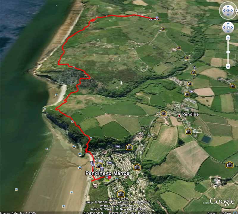
This is a linear coastal walk using the local bus from Marros to Pendine.   
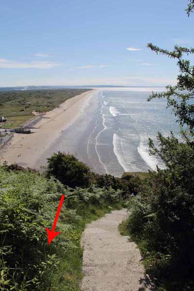
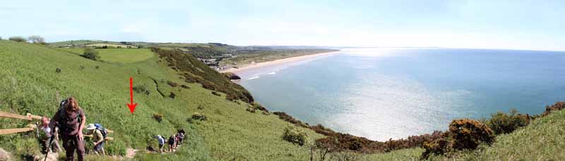
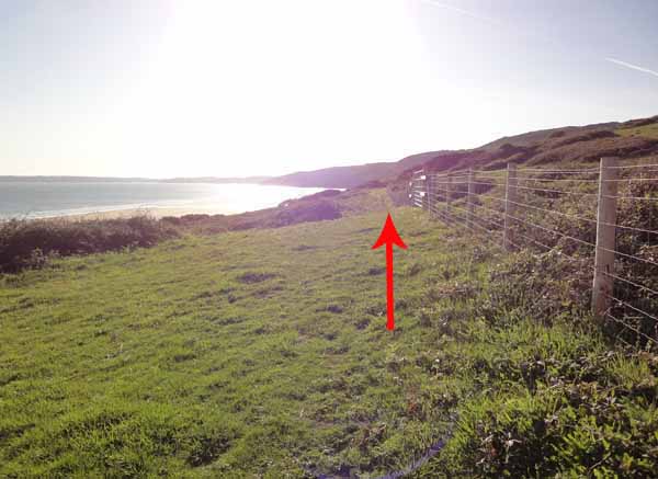
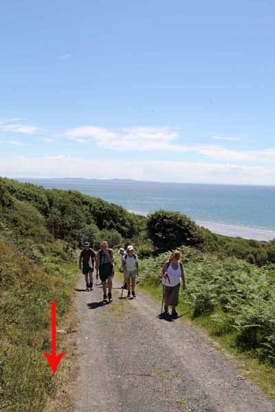
The views from the coast are magnificent and as you head west you begin to walk on rocks that were laid down millions of years ago when Wales was part of the same continent as The Appalachian Mountains of America.    The Pembrokeshire Coast Path is now officially part of the International Appalachian Trail and a future article will take us from Marros onto the start of the trail.   The All Wales Coast Path will officially open on the May Bank Holiday 2012 so watch out for more walks on the coast.

Park in Marros and catch the bus from opposite the church.  Frequency is about two hours Monday to Saturday so check times before leaving home.
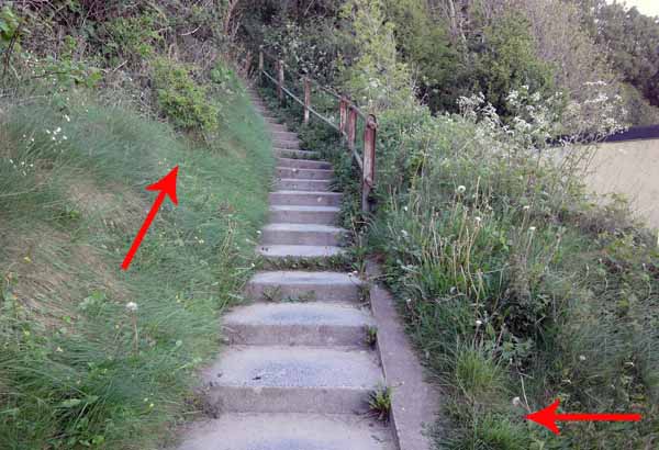
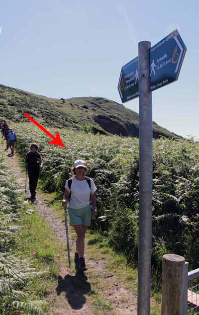
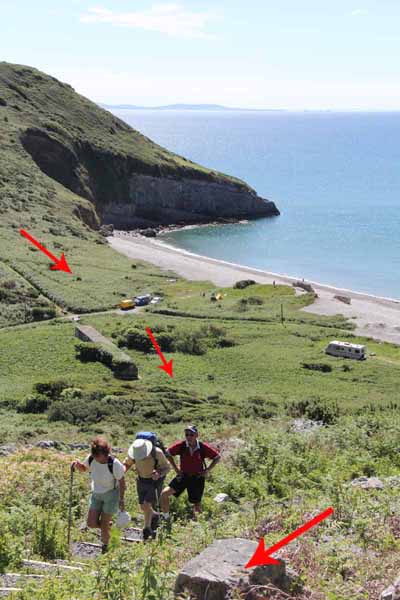
The 10 minute journey takes you into Pendine where you follow the coast west to the bottom of the cliff.  A flight of steps take you high onto the cliff-top.
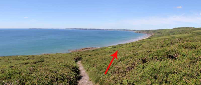
Don't be fooled into thinking you have finished the climb as the path continues upward until a steep descent drops into the valley.  The path climbs the other side of the cliff onto Ragwen Point. 
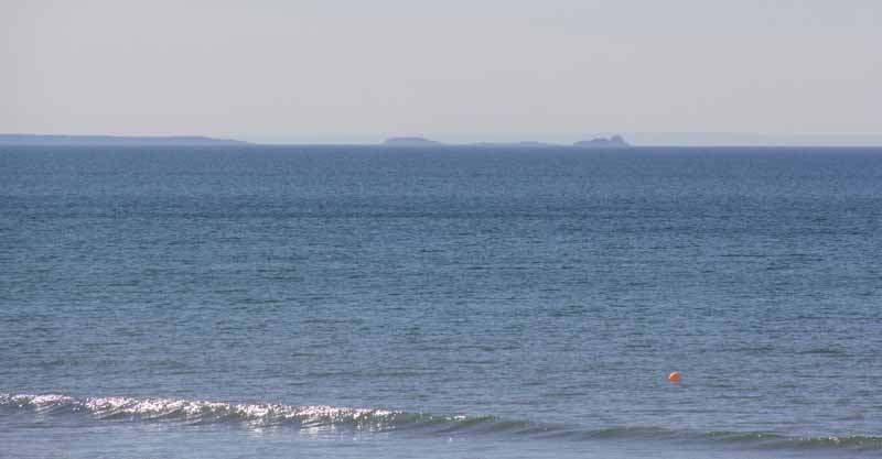
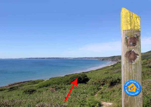
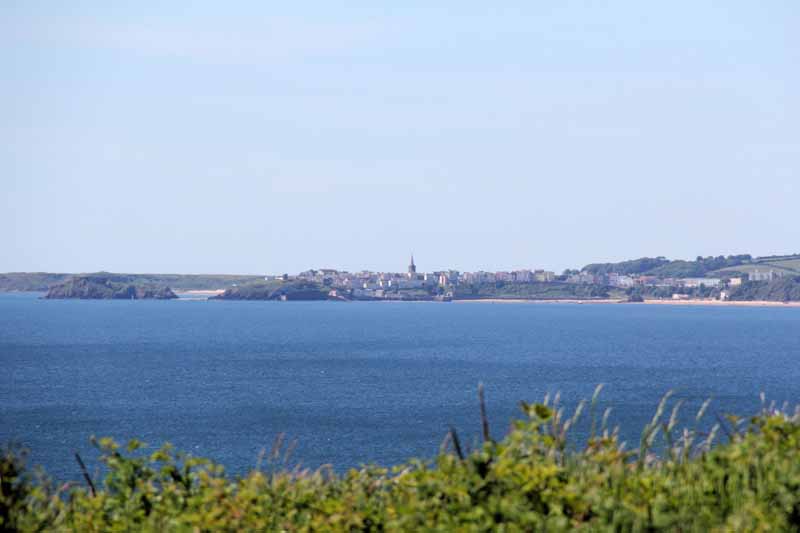
Turn left onto the track and ascend, following the All Wales Coast Path signs.  Watch for Worms Head and Tenby across the water.
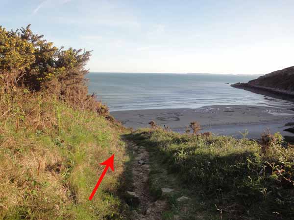
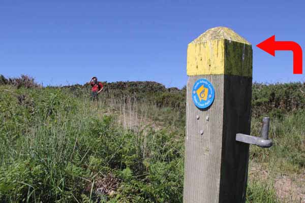
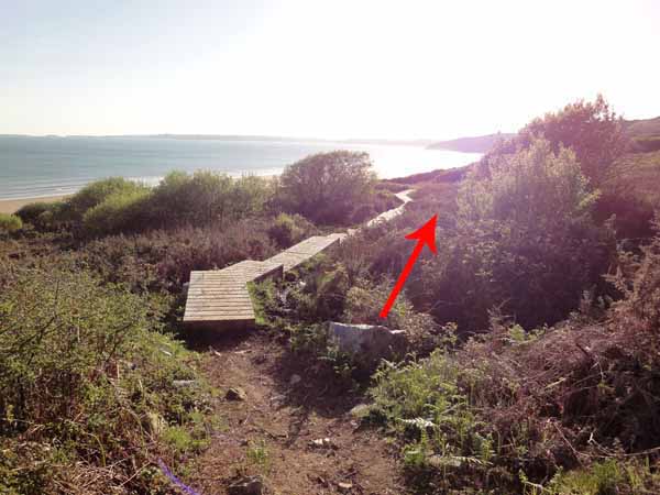
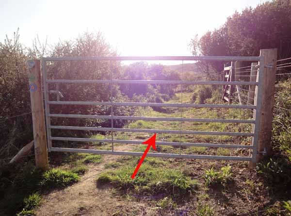
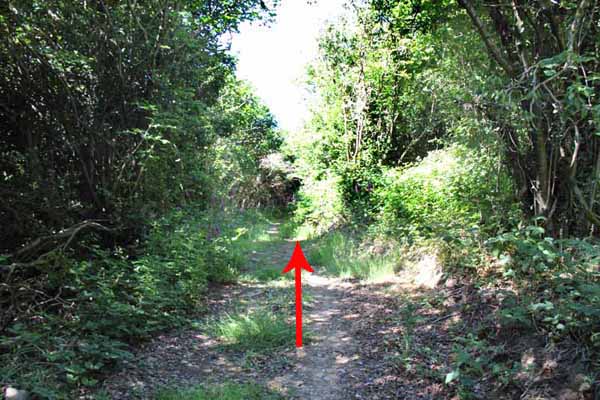
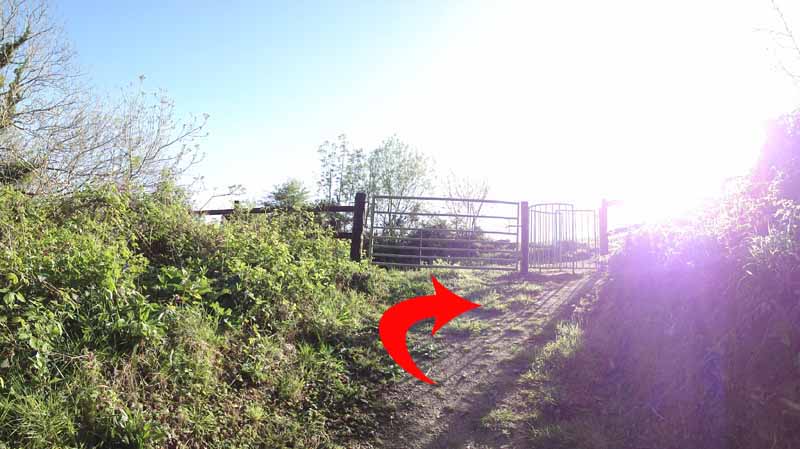
The path follows a board walk and eventually a fence line to enter a gate onto a new track through woodland.  After about a mile this emerges at a gate onto a broad track.
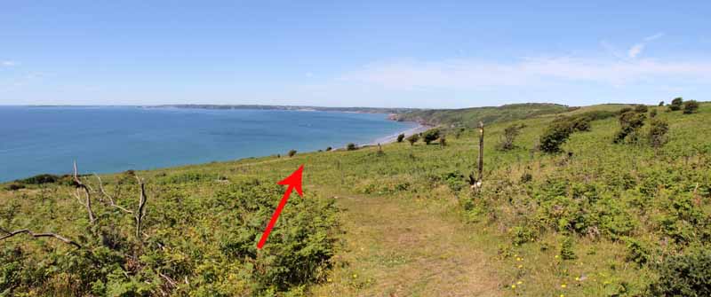
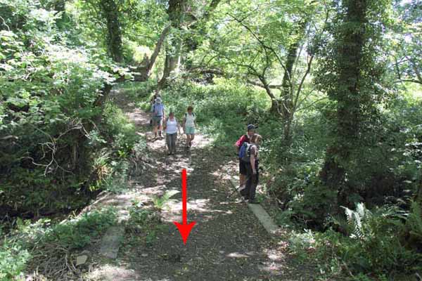
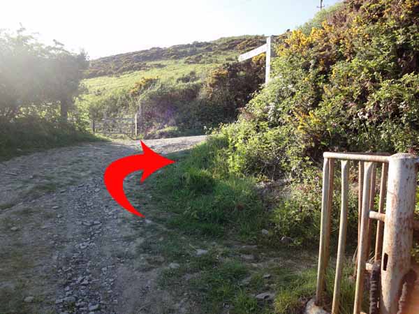
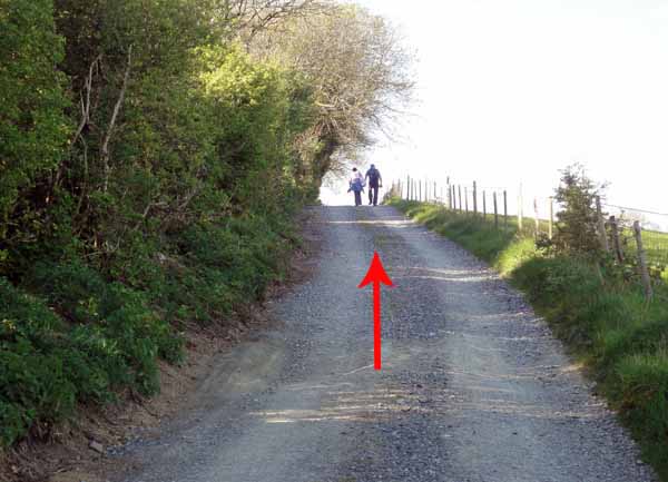
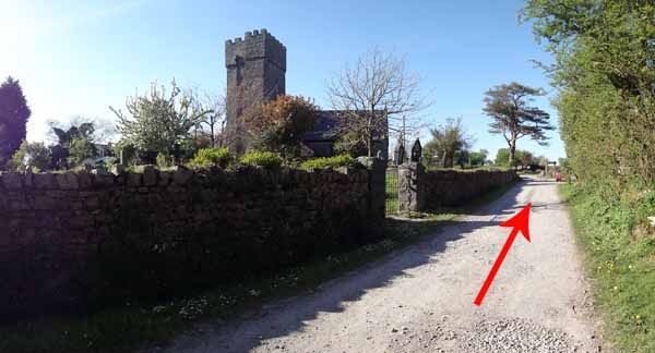
Continue uphill to a hairpin bend junction with Underhill Farm.  Here another walk could continue along the coast path but today we turn right and follow the broad track uphill for about a mile to Marros Church.


Ramblers Cymru and Swansea Ramblers provide these routes but accept no responsibility for those walking them.

If you would like to go on a walk but would prefer to do so with a group of people then click on our Programme section to see what walks we are leading.

We have walks for varying levels of ability and you get the chance to see the countryside in places you might never go by yourself!


Maps of the Walk


Ordnance Survey map of the route to walk
Resizable and draggable
(Can be reset to original dimensions by refreshing the page)
Green Swansea Ramblers logo markers where present can be clicked to provide more information


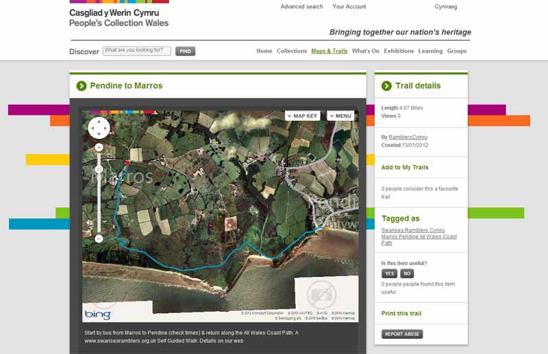
This aerial map is resizable and draggable
(Can be reset to original dimensions by refreshing the page)

A 25,000 Ordnance Survey map of the area
can be viewed by clicking on the above 'View Larger Map' option
(applies only if the above is a Bing map, not a Google map )


Peoples Collection link

The route of this walk has been added to The National Museum of Wales' Peoples Collection Web site.
A choice of aerial imagery or historic Ordnance Survey mapping is available.
Click the map to enter their web site (opens in a new browser window)
or copy and paste this link into a new browser window.
http://www.peoplescollectionwales.co.uk/Trail/817-pendine-to-marros


Google Earth view of walk
If you have Google Earth installed then download the route by clicking the image

Google Earth allows you to fly over the route and see it from different angles
(The Google Earth application can be downloaded and installed from the options on the Google search page)


Photographs of the Walk


Photograph of Walking Route - Image 1
Walk west along the coast to the cliff


Photograph of Walking Route - Image 2
Worms Head in Gower across the bay


Photograph of Walking Route - Image 3
Walk to the end of the promenade


Photograph of Walking Route - Image 4
Some uphill walking now as you climb these steps


Photograph of Walking Route - Image 5
Once you have walked half way up look back at the view


Photograph of Walking Route - Image 6


Photograph of Walking Route - Image 7
Flat for a while but another climb to follow


Photograph of Walking Route - Image 8
Quite steep walking up here


Photograph of Walking Route - Image 9
Descend to the valley floor


Photograph of Walking Route - Image 10
At the bottom follow the footpath sign towards Amroth


Photograph of Walking Route - Image 11
Another steep walk up the side of the valley


Photograph of Walking Route - Image 12
At the top turn left onto a track


Photograph of Walking Route - Image 13
Views open out with Tenby and Caldy Island in the distance


Photograph of Walking Route - Image 14


Photograph of Walking Route - Image 15
Watch out for the All Wales Coast Path signs


Photograph of Walking Route - Image 16
A board walk takes you over the boggy area


Photograph of Walking Route - Image 17
Tenby in the distance


Photograph of Walking Route - Image 18
The path then follows the fence line towards a gate into a wooded path


Photograph of Walking Route - Image 19


Photograph of Walking Route - Image 20
The woodland walk continues for about a mile. Ignore paths that cross it


Photograph of Walking Route - Image 21
Nice to get some shade on a hot day


Photograph of Walking Route - Image 22
Exit right onto a broad track


Photograph of Walking Route - Image 23
Follow the track uphill


Photograph of Walking Route - Image 24
Turn right to at the hairpin bend by Underhill to continue on the broad track


Photograph of Walking Route - Image 25
Still walking uphill but remember to look back at the Worms Head


Photograph of Walking Route - Image 26
After about half a mile the track comes to the church


Photograph of Walking Route - Image 27
The War Memorial by the church at the end of the walk


More information about walking in Wales is available at:    www.ramblers.org.uk/wales

Ramblers Cymru and Swansea Ramblers provide this route but accept no responsibility for those walking it

All photographs Copyright 2012 Andrew Morgan. All rights reserved


Swansea Ramblers hope you enjoy doing this walk.

Over time things can change on the walk

- for example - path diversions, new gates instead of stiles or maybe the path has become blocked.

If you do find anything different on the way then let us know:

1. Which walk you have been on.

2. The type and location of the change or the problem you have experienced.


Of course you may just like to tell us that you have done the walk and whether you enjoyed it.

Use the link below to email us about your walk.

We'll look forward to hearing from you.


If the email link is not displayed above or is not supported by your email setup, manually type in our email address
address


Back to top

Our use of Cookies

Our Privacy Policy


Valid HTML 4.01 Transitional