Ramblers Cymru Logo Image of Countryside
Swansea Ramblers Logo
at the heart of walking


Swansea Ramblers Walk


Llanelli - Cwm Lliedi Reservoir


Walk Start / Finish Location:
Car Park between the upper and lower Cwm Lliedi reservoirs

Walk Distance: 2 miles (1.5 hours)

Walk Level: Easy - some uneven sections

Parking: Car Park between the upper and lower Cwm Lliedi reservoirs (Free)

Transport: Traveline - www.traveline.info   - or - Telephone 0871 200 22 33


Walk Description


This walk makes a circuit of the reservoir so keep the water to your right & you shouldn't go far wrong!
A popular area for anglers and dog walkers and is mostly flat and even.
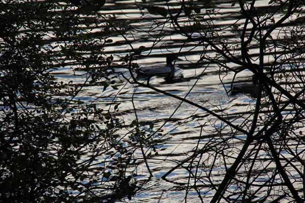
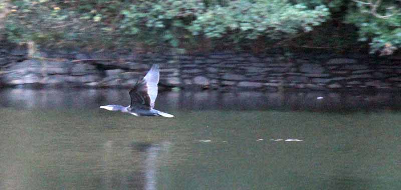
There are some good views of the water and you should see wildfowl using it.

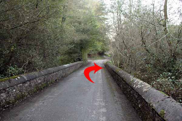
The single track road passes the farm of Ystradfai at a bend.
The eagle eyed might spot the back of this farm later on from the woodland path.
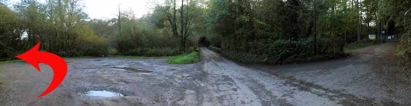
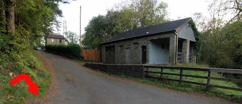
Continue down the road and park on the left side of the road in the car park.
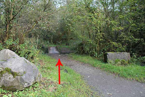
Take the path in the corner of the car park and over the footbridge.
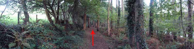
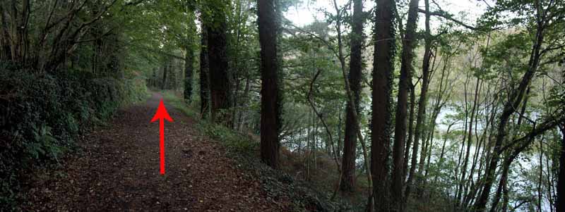
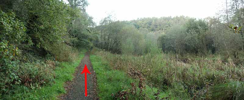
This is an easy to follow route and soon brings you in sight of the water's edge.
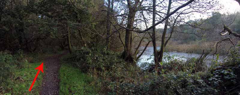
You will probably pass a few anglers on the way, especially if you do the walk towards the end of the day.
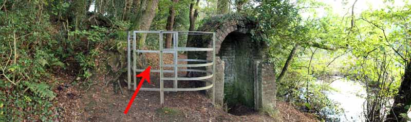
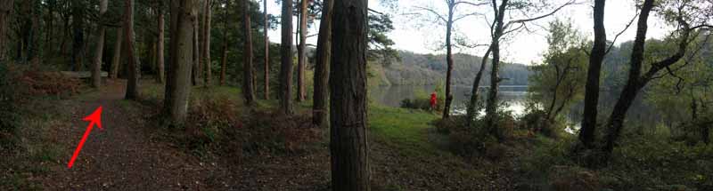
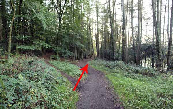
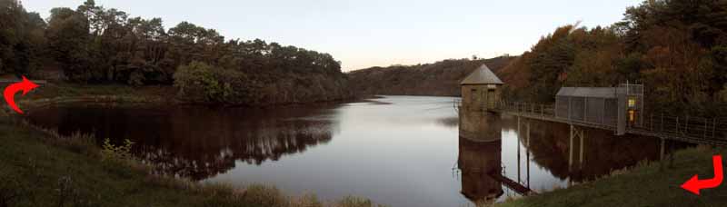
Go through the woodland, passing through a kissing gate and continuing until the path comes to a viewpoint on the bend of the reservoir.
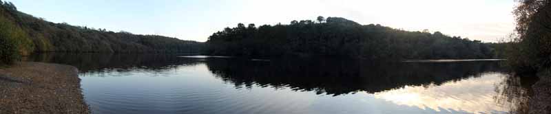
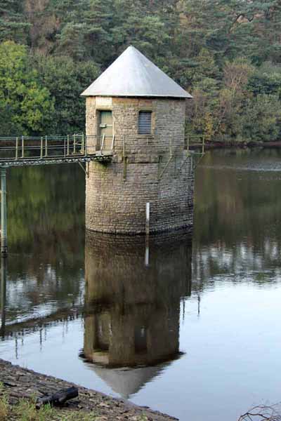
A vast open area of water lies before you.
Take in the view then rejoin the path, Continue straight on, ignoring a left fork.
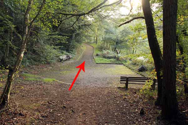
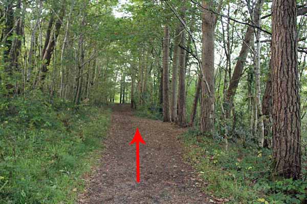
The woodland path emerges onto an area with seats and a more even path to the dam wall.
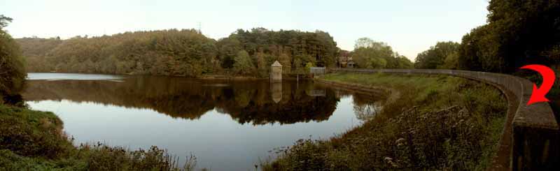
Turn right to cross the dam then continue to follow the path that runs parallel with the reservoir.
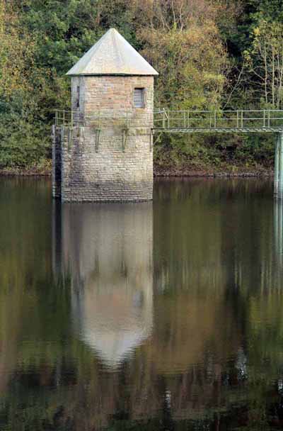
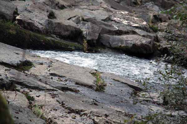
Eventually a second dam wall (a weir) appears - which you might have noticed earlier from the other side.
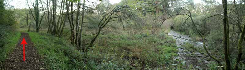
Continue straight on along the well defined path.
The water of the reservoir gives way to a marshy area providing a different habitat for wildlife.
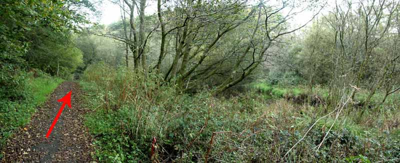
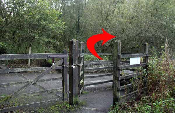
A gate takes you onto the single track road again.
Turn right and after a few yards you arrive back at the car park.


Ramblers Cymru and Swansea Ramblers provide these routes but accept no responsibility for those walking them.

If you would like to go on a walk but would prefer to do so with a group of people then click on our Programme section to see what walks we are leading.

We have walks for varying levels of ability and you get the chance to see the countryside in places you might never go by yourself!


Maps of the Walk


Ordnance Survey map of the route to walk
Resizable and draggable
(Can be reset to original dimensions by refreshing the page)
Green Swansea Ramblers logo markers where present can be clicked to provide more information


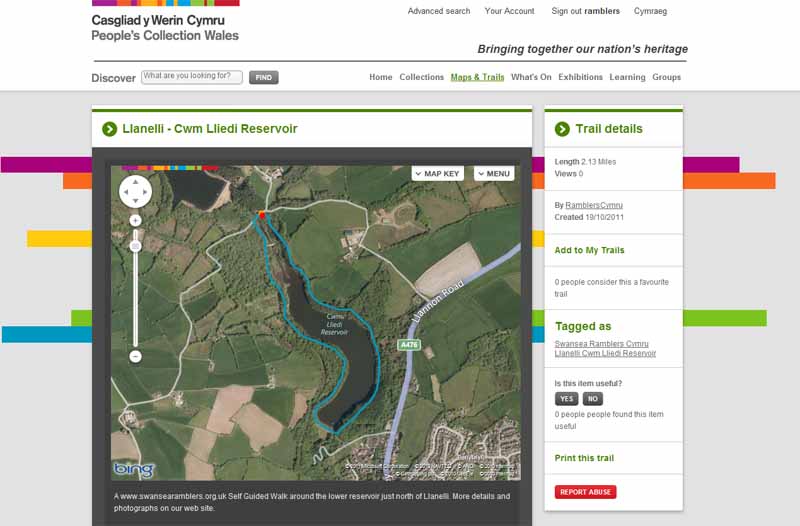
This aerial map is resizable and draggable
(Can be reset to original dimensions by refreshing the page)

A 25,000 Ordnance Survey map of the area
can be viewed by clicking on the above 'View Larger Map' option
(applies only if the above is a Bing map, not a Google map )


Peoples Collection link

The route of this walk has been added to The National Museum of Wales' Peoples Collection Web site.
A choice of aerial imagery or historic Ordnance Survey mapping is available.
Click the map to enter their web site (opens in a new browser window)
or copy and paste this link into a new browser window.
http://www.peoplescollectionwales.co.uk/Trail/787-llanelli---cwm-lliedi-reservoir


Photographs of the Walk


Photograph of Walking Route - Image 1
Park here and follow the path over the footbridge


Photograph of Walking Route - Image 2
Cross the footbridge


Photograph of Walking Route - Image 3
Follow the path keeping the water to your right


Photograph of Walking Route - Image 4


Photograph of Walking Route - Image 5


Photograph of Walking Route - Image 6


Photograph of Walking Route - Image 7
The path comes to a waterside clearing


Photograph of Walking Route - Image 8


Photograph of Walking Route - Image 9
There is an extensive view of the reservoir


Photograph of Walking Route - Image 10
Continue straight on


Photograph of Walking Route - Image 11


Photograph of Walking Route - Image 12
The path meets the road at the bottom of the reservoir


Photograph of Walking Route - Image 13


Photograph of Walking Route - Image 14
Continue around the reservoir


Photograph of Walking Route - Image 15


Photograph of Walking Route - Image 16


Photograph of Walking Route - Image 17


Photograph of Walking Route - Image 18


Photograph of Walking Route - Image 19
Go past the weir


Photograph of Walking Route - Image 20
The stone weir and the path are at right angles
(the perspective of the photograph distorts the angle)


Photograph of Walking Route - Image 21


Photograph of Walking Route - Image 22


Photograph of Walking Route - Image 23
Turn right onto the road


Photograph of Walking Route - Image 24
After a few yards you will return to the car park


More information about walking in Wales is available at:    www.ramblers.org.uk/wales

Ramblers Cymru and Swansea Ramblers provide this route but accept no responsibility for those walking it

All photographs Copyright 2012 Andrew Morgan. All rights reserved


Swansea Ramblers hope you enjoy doing this walk.

Over time things can change on the walk

- for example - path diversions, new gates instead of stiles or maybe the path has become blocked.

If you do find anything different on the way then let us know:

1. Which walk you have been on.

2. The type and location of the change or the problem you have experienced.


Of course you may just like to tell us that you have done the walk and whether you enjoyed it.

Use the link below to email us about your walk.

We'll look forward to hearing from you.


If the email link is not displayed above or is not supported by your email setup, manually type in our email address
address


Back to top

Our use of Cookies

Our Privacy Policy


Valid HTML 4.01 Transitional