Ramblers Cymru Logo Image of Countryside
Swansea Ramblers Logo
at the heart of walking


Swansea Ramblers Walk


Oxwich National Nature Reserve


Walk Start / Finish Location:
Oxwich Bay Car Park

Walk Distance: 3 miles (2 hours)

Walk Level: Easy

Parking: Oxwich Bay Car Park (Charge)

Transport: Traveline - www.traveline.info   - or - Telephone 0871 200 22 33


Walk Description


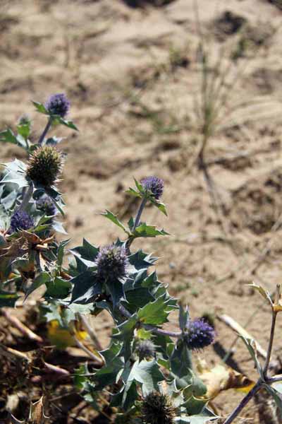
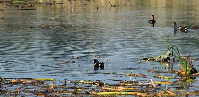
This is a walk for any time of year with spring flowers, summer butterflies and dragonflies, autumn tints and fresh winter walking.
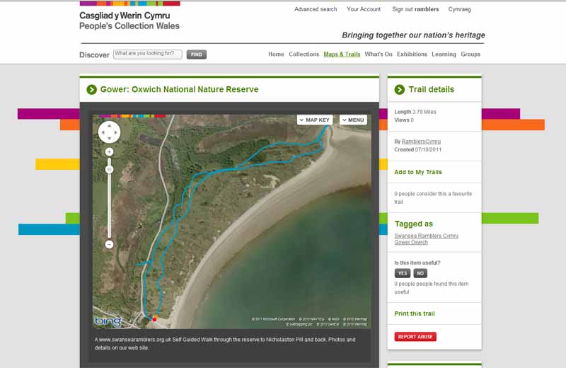
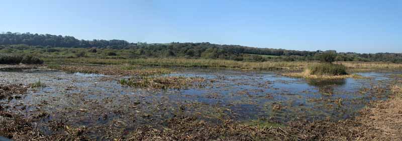
The walk goes to the new bird hide which overlooks the water in the fen.

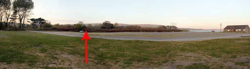
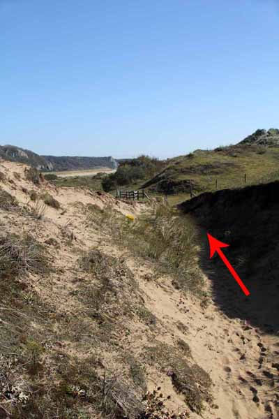
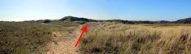
Start at a way marked footpath in middle of the eastern side of the car park which ascends the dune.
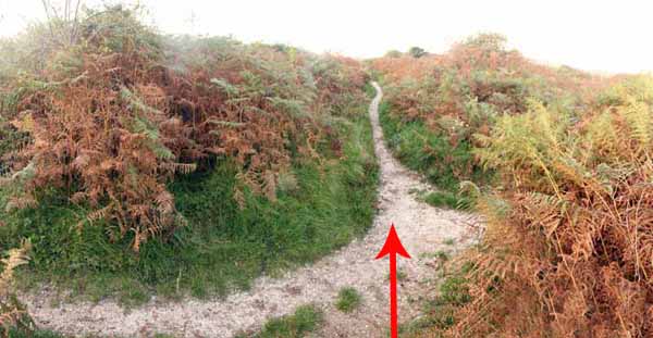
Follow it through the dunes to a junction then continue along a cockleshell path for some distance to a wide green track.
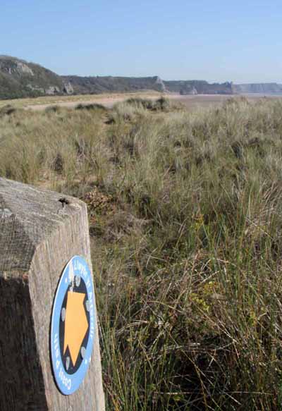
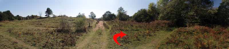
Turn right along this track bears right onto another path at a coast path sign.
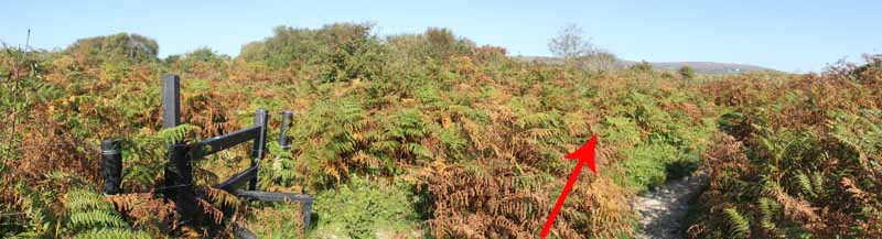
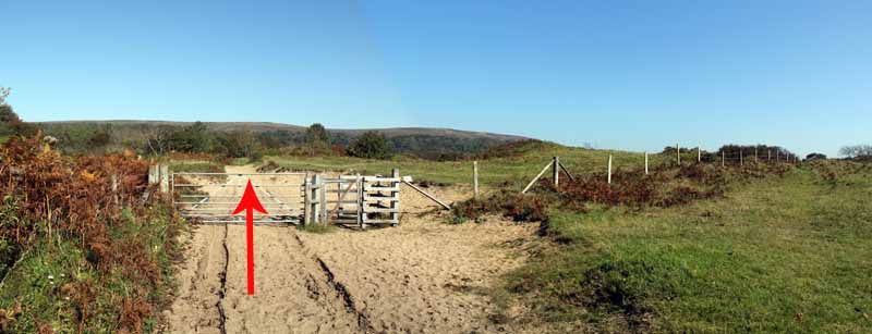
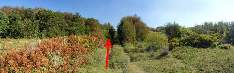
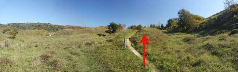
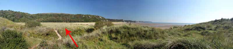
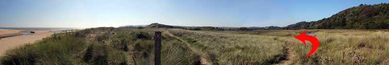
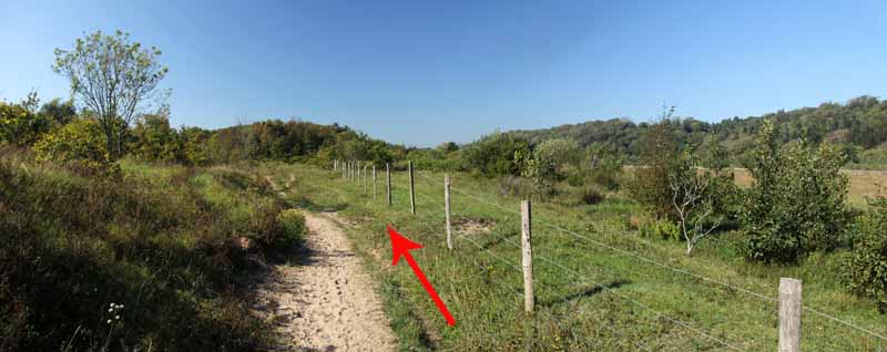
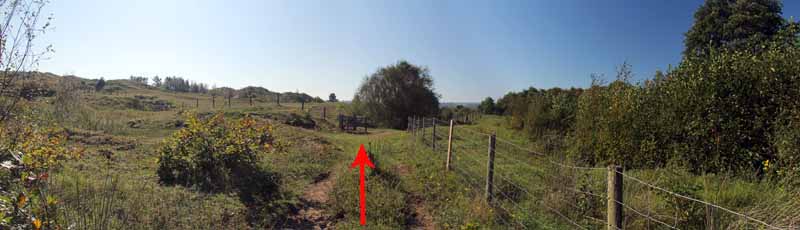
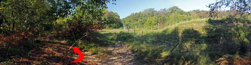
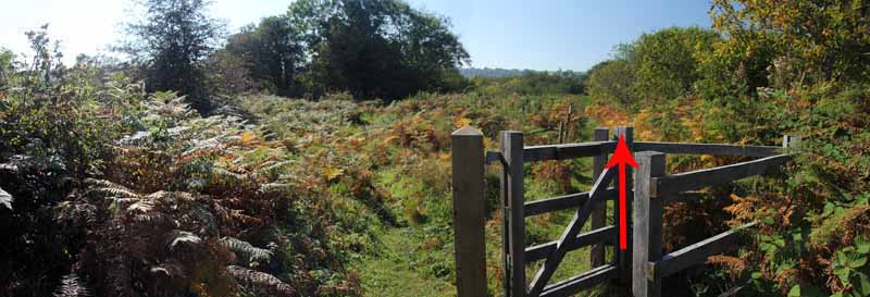
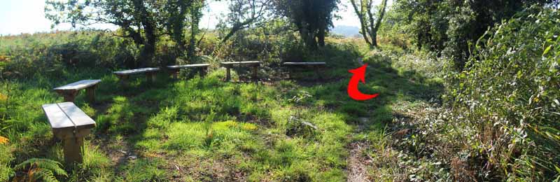
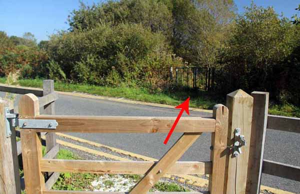
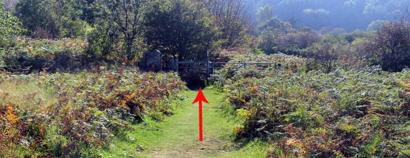
Follow the broad track past another signpost and through a section enclosed by trees then bear right at a post near the fence (see photos on web).
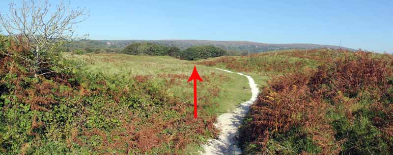
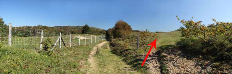
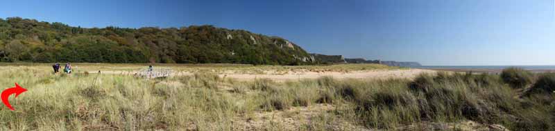
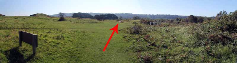
Go through a gate in broad grassland and note on the left another gate which you will use on the way back.
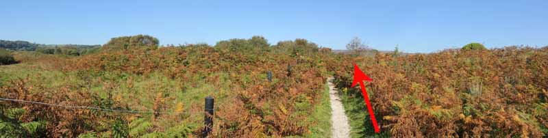
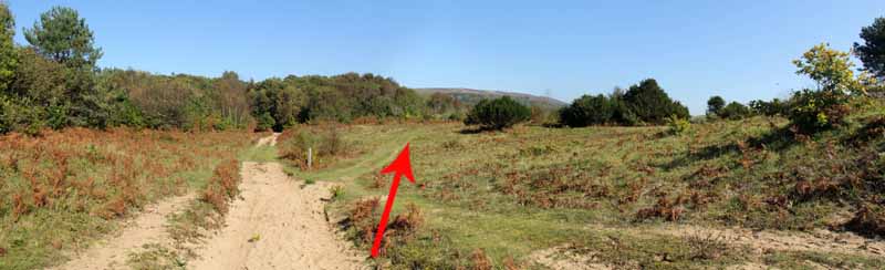
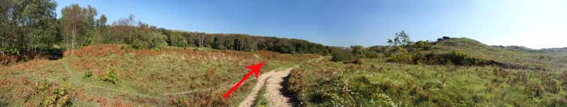
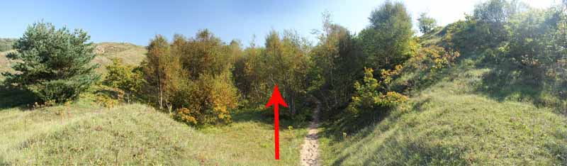
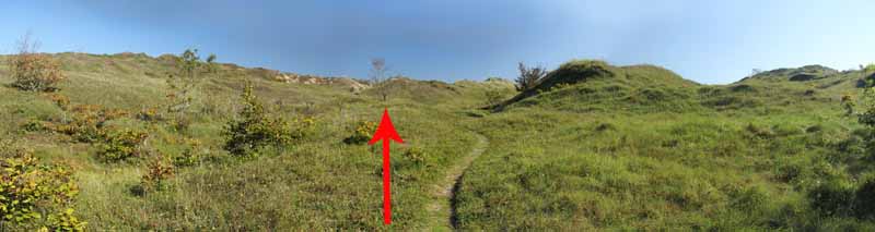
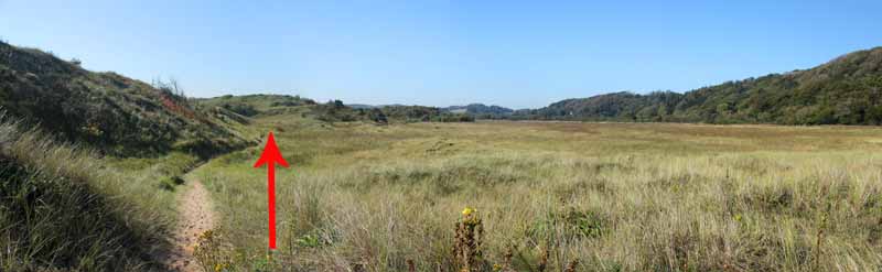
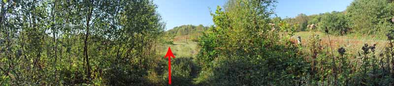
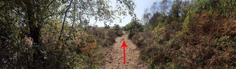
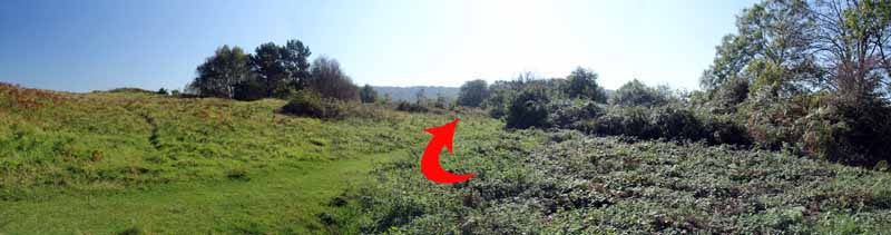
The track goes between a high dune and some trees then takes an undulating but clear path eastward.
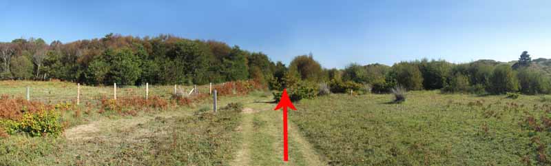
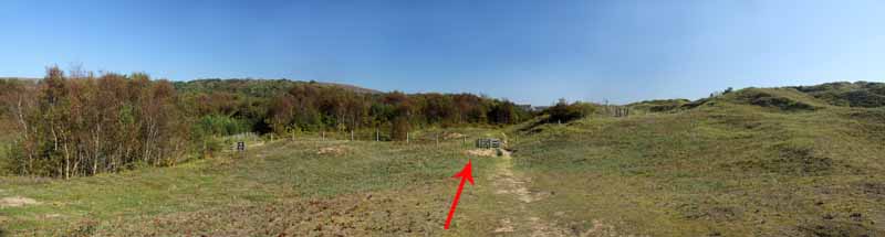
When going through another gate, note on the left yet another gate for the return journey near the marsh.
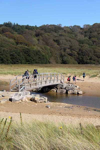
Follow coast path signs to Nicholaston Pill and the bridge that Swansea Ramblers helped to build.
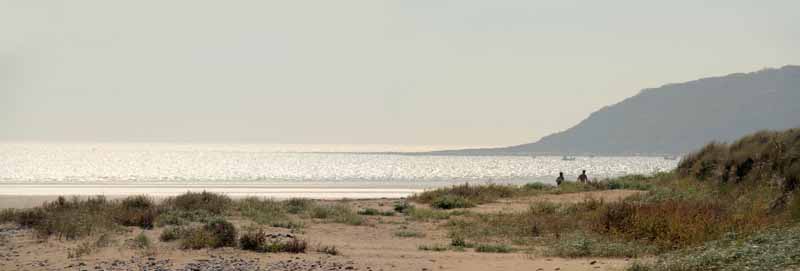
You have the choice to turn right and return to the start point via the beach.
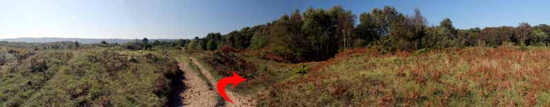
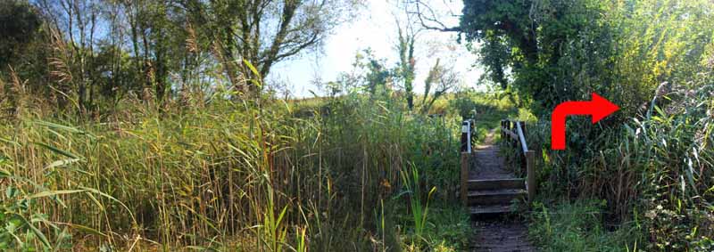
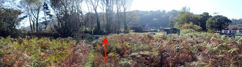
The main walk re-traces the way you came for a hundred yards then turns right, following the edge of the marsh into the reserve.
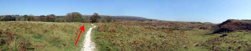
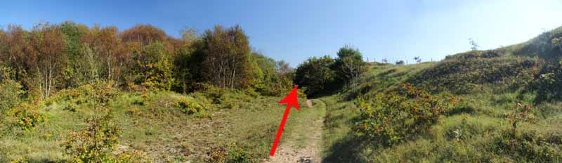
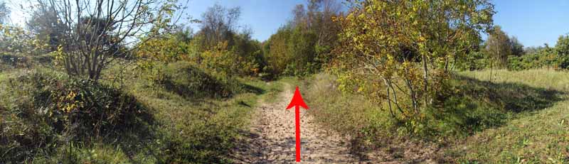
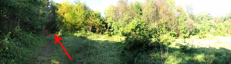
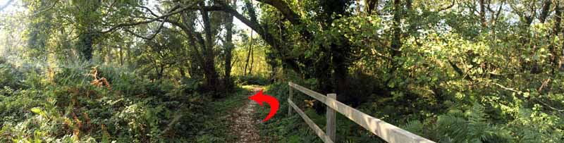
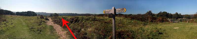
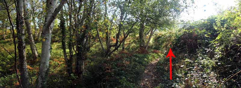
Follow the broad track through woodland then at another coast path post bear left away from the fence along the grassy path.
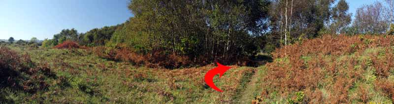
Watch for a gap between trees on the right and follow this back to the fence.
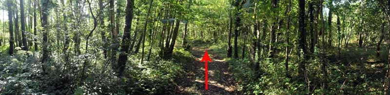
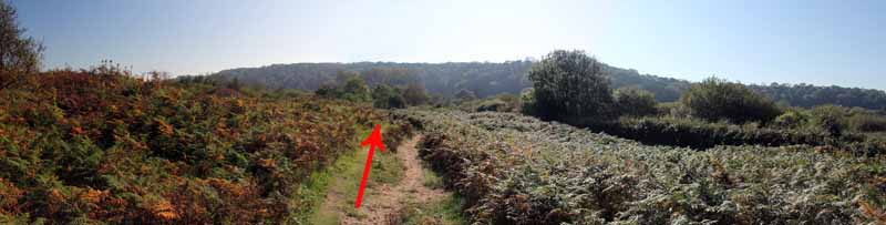
Turn left and go along the broad path. This goes through a small area of woodland then emerges back on the broad path.
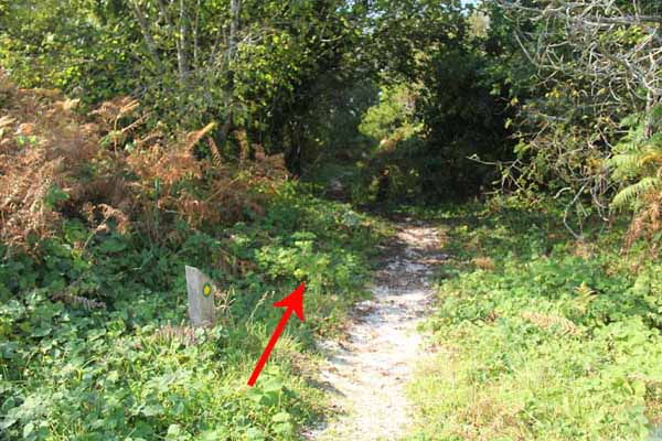
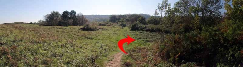
Watch for the low signpost and turn right into woodland.
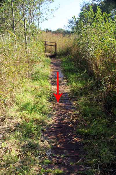
Emerging onto grassland turn right to a gate for the boardwalk.
The boards are only just above the water line so don't be surprised if water starts to seep through the gaps!
Continue along the path into the open grassland and head past a tall coast path post near a gate onto the marsh road.
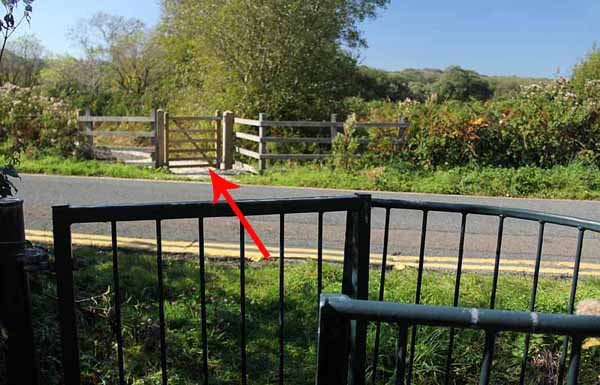
Watch carefully on the right for a kissing gate onto the road.
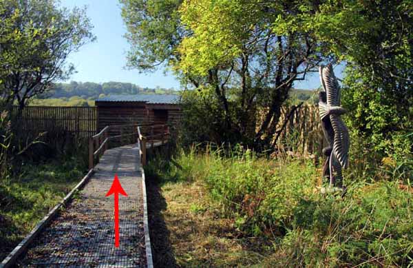
Watch for traffic as you cross to the boardwalk which leads to the bird hide.
Remember to be quiet on the way to and from the hide not to disturb any bird life.
After visiting the hide re-trace the route back through the kissing gate and turn right to follow the path back to the car park.


Ramblers Cymru and Swansea Ramblers provide these routes but accept no responsibility for those walking them.

If you would like to go on a walk but would prefer to do so with a group of people then click on our Programme section to see what walks we are leading.

We have walks for varying levels of ability and you get the chance to see the countryside in places you might never go by yourself!


Maps of the Walk


Ordnance Survey map of the route to walk
Resizable and draggable
(Can be reset to original dimensions by refreshing the page)
Green Swansea Ramblers logo markers where present can be clicked to provide more information


This aerial map is resizable and draggable
(Can be reset to original dimensions by refreshing the page)

A 25,000 Ordnance Survey map of the area
can be viewed by clicking on the above 'View Larger Map' option
(applies only if the above is a Bing map, not a Google map )


Peoples Collection link

The route of this walk has been added to The National Museum of Wales' Peoples Collection Web site.
A choice of aerial imagery or historic Ordnance Survey mapping is available.
Click the map to enter their web site (opens in a new browser window)
or copy and paste this link into a new browser window.
http://www.peoplescollectionwales.co.uk/Trail/779-gower-oxwich-national-nature-reserve


Photographs of the Walk


Photograph of Walking Route - Image 1
A way-marked post in the car park leads into the dunes


Photograph of Walking Route - Image 2
Follow the path to a junction with a cockleshell path


Photograph of Walking Route - Image 3
Continue straight on at the junction


Photograph of Walking Route - Image 4
Follow the cockleshell path some way through the dunes


Photograph of Walking Route - Image 5


Photograph of Walking Route - Image 6
Ignore the stile


Photograph of Walking Route - Image 7
Go through the kissing gate


Photograph of Walking Route - Image 8


Photograph of Walking Route - Image 9
Watch for Penrice old and new castles and Penrice Church on the hillside


Photograph of Walking Route - Image 10


Photograph of Walking Route - Image 11
Turn right at the end of the cockleshell path


Photograph of Walking Route - Image 12


Photograph of Walking Route - Image 13
Bear right at the wooden sign post


Photograph of Walking Route - Image 14


Photograph of Walking Route - Image 15


Photograph of Walking Route - Image 16
Note the left track for the return journey


Photograph of Walking Route - Image 17
Go straight on at the coast path sign post


Photograph of Walking Route - Image 18


Photograph of Walking Route - Image 19
Bear right at the next post


Photograph of Walking Route - Image 20
Go through the right gate, noting the left gate for the return


Photograph of Walking Route - Image 21


Photograph of Walking Route - Image 22
Follow the path and coast path posts


Photograph of Walking Route - Image 23


Photograph of Walking Route - Image 24


Photograph of Walking Route - Image 25


Photograph of Walking Route - Image 26
Great Tor comes into view


Photograph of Walking Route - Image 27
Go through the gate, noting the lower gate on the left for the return


Photograph of Walking Route - Image 28


Photograph of Walking Route - Image 29
Coast path sign with view of Great Tor


Photograph of Walking Route - Image 30
Coast view disappears as you head for the hidden bridge


Photograph of Walking Route - Image 31
Holly in flower (October)


Photograph of Walking Route - Image 32
Note the marsh on the left as the path bears right for the bridge


Photograph of Walking Route - Image 33
The top of the bridge appears


Photograph of Walking Route - Image 34
Swansea Ramblers helped build this bridge for the All Wales Coast Path


Photograph of Walking Route - Image 35
It replaced a low level bridge more prone to flooding


Photograph of Walking Route - Image 36
The other side of the bridge is lovely walking but that's for another day
See the 360 degree video at end of photographs


Photograph of Walking Route - Image 37
If you want to you can walk back along the beach


Photograph of Walking Route - Image 38
The main walk doubles back for a hundred yards to the marsh edge


Photograph of Walking Route - Image 39
Bear right here instead of returning by the same route


Photograph of Walking Route - Image 40
This leads to a dry path close to the marsh


Photograph of Walking Route - Image 41


Photograph of Walking Route - Image 42
This is the lower gate you saw earlier


Photograph of Walking Route - Image 43
You could go right and into the marsh but that's for another day


Photograph of Walking Route - Image 44


Photograph of Walking Route - Image 45
The path goes into woodland


Photograph of Walking Route - Image 46


Photograph of Walking Route - Image 47
Here's the lower of the first pair of gates


Photograph of Walking Route - Image 48


Photograph of Walking Route - Image 49
Watch carefully for this right turn into woodland


Photograph of Walking Route - Image 50


Photograph of Walking Route - Image 51
Keep to the woodland path


Photograph of Walking Route - Image 52


Photograph of Walking Route - Image 53


Photograph of Walking Route - Image 54
Soon you emerge back onto the main path


Photograph of Walking Route - Image 55
Dragonflies are still flying around (October)


Photograph of Walking Route - Image 56
Go back into woodland just before the low way post (on left)


Photograph of Walking Route - Image 57
Another short woodland detour


Photograph of Walking Route - Image 58


Photograph of Walking Route - Image 59
Bear right after emerging from the woodland


Photograph of Walking Route - Image 60
The gate leads to the boardwalk


Photograph of Walking Route - Image 61
The planks are so low in the water that it seeps through as you step on them - kids will love it!


Photograph of Walking Route - Image 62


Photograph of Walking Route - Image 63
The boardwalk ends at seats and a pond dipping platform


Photograph of Walking Route - Image 64


Photograph of Walking Route - Image 65
Go past the reserve sign and the vehicle gate by the roadside


Photograph of Walking Route - Image 66
Continue straight on along the coast path


Photograph of Walking Route - Image 67
Watch for the hidden kissing gate on the right


Photograph of Walking Route - Image 68
Cross carefully - the road can be busy


Photograph of Walking Route - Image 69
The new bird hide - approach then leave quietly not to disturb the birds


Photograph of Walking Route - Image 70
View from inside the hide


Photograph of Walking Route - Image 71


Photograph of Walking Route - Image 72
Return to the road and cross over


Photograph of Walking Route - Image 73
Bear right and rejoin the coast path


Photograph of Walking Route - Image 74


Photograph of Walking Route - Image 75
The path runs parallel with the road for a while


Photograph of Walking Route - Image 76
The exit from the reserve


Photograph of Walking Route - Image 77
The path returns to the car park entrance. Watch for cars!


Video: A 360 degree view from Nicholaston Pill Bridge
Duration: 0m 31s


More information about walking in Wales is available at:    www.ramblers.org.uk/wales

Ramblers Cymru and Swansea Ramblers provide this route but accept no responsibility for those walking it

All photographs Copyright 2012 Andrew Morgan. All rights reserved


Swansea Ramblers hope you enjoy doing this walk.

Over time things can change on the walk

- for example - path diversions, new gates instead of stiles or maybe the path has become blocked.

If you do find anything different on the way then let us know:

1. Which walk you have been on.

2. The type and location of the change or the problem you have experienced.


Of course you may just like to tell us that you have done the walk and whether you enjoyed it.

Use the link below to email us about your walk.

We'll look forward to hearing from you.


If the email link is not displayed above or is not supported by your email setup, manually type in our email address
address


Back to top

Our use of Cookies

Our Privacy Policy


Valid HTML 4.01 Transitional