Ramblers Cymru Logo Image of Countryside
Swansea Ramblers Logo
at the heart of walking


Swansea Ramblers Walk


Penllergare Estate


Walk Start / Finish Location:
A48 layby opposite Pit Stop Cafe (nr Jct 47 M4)

Walk Distance: 2 miles (1.5 hours)

Walk Level: Easy

Parking: A48 layby opposite Pit Stop Cafe (Free)

Transport: Traveline - www.traveline.info   - or - Telephone 0871 200 22 33


Walk Description


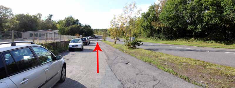
The old main road is usually bypassed by the busy traffic using the M4
but if you take the eastbound carriageway of the A48 just off the Penllergaer roundabout at junction 47
there is a lay-by opposite the Pit Stop cafe where you can begin a woodland walk.
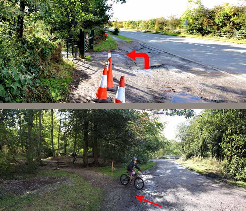
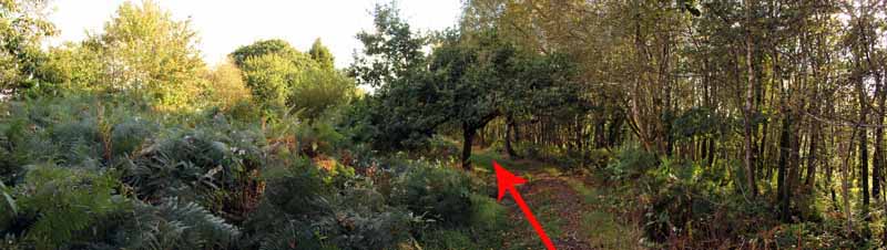
Use the metal kissing gate on the roadside that leads into Penllergare Woods (note the old spelling).
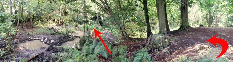
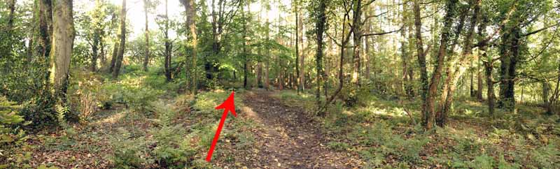
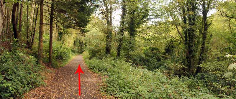
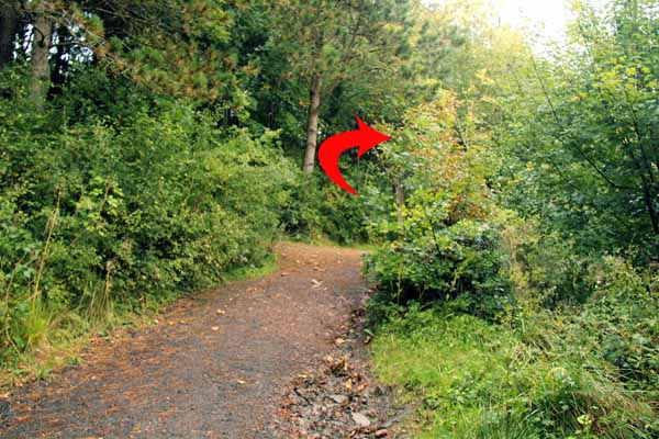
Take the left woodland path (not the vehicle track) and follow the path through some woodland.
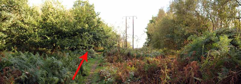
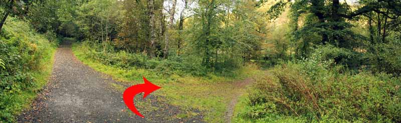
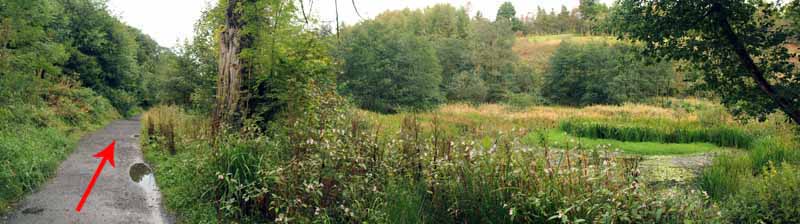
At a junction, turn left onto a wider path where the tree canopy opens up
and there is a brief view through power lines towards the ridge of Hendrefoilan.
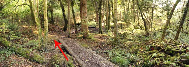
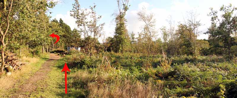
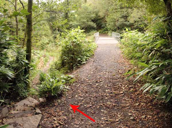
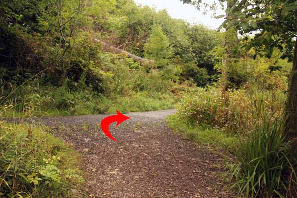
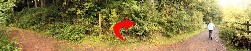
Take the left path at a wooden way marked post that goes through more woodland until it emerges on a broad dirt road.
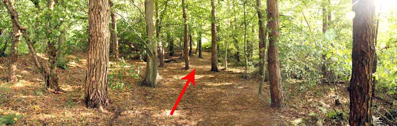
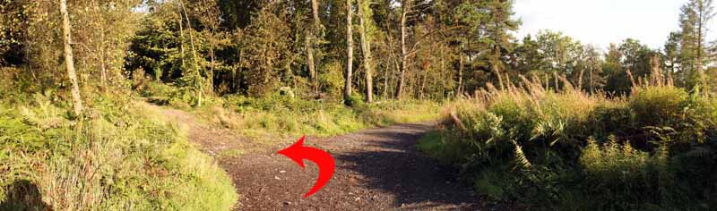
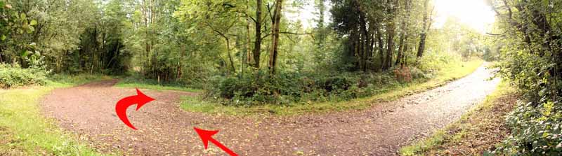
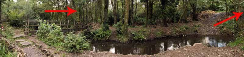
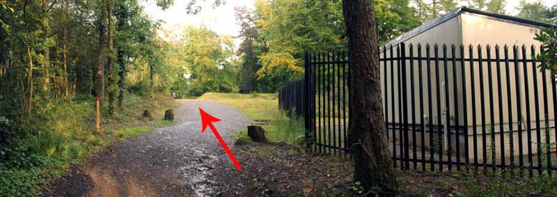
Turn left then right and go downhill to a junction with another path.
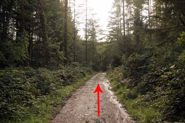
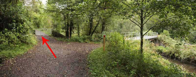
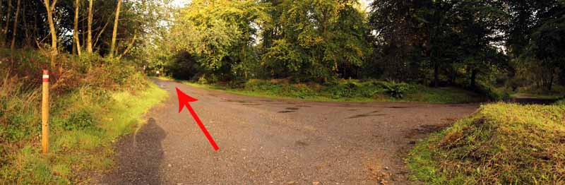
Turn left and follow this broad track until it curves right to the Sapper Bridge.
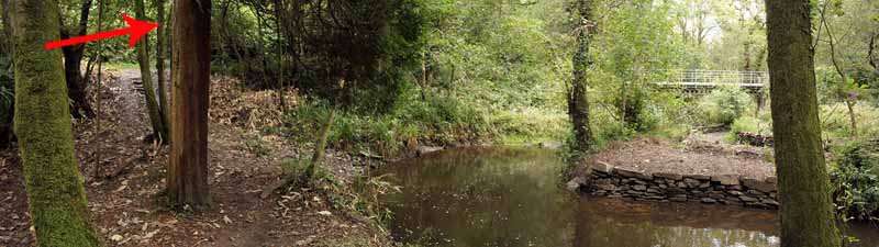
Either climb over the metal barrier to cross this first bridge
or descend left to the older bridge below and walk around to the other side of the first bridge.
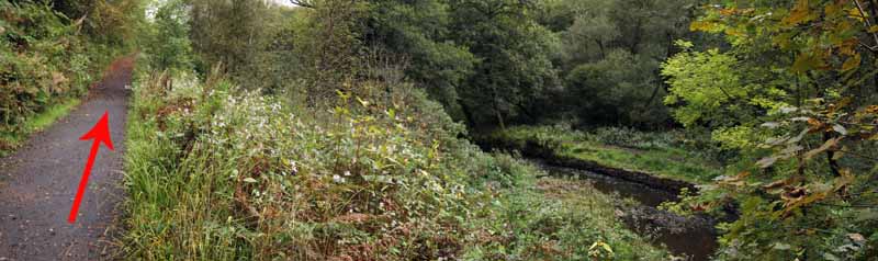
Go through a gate and start the return journey along another broad path, this time on the other side of the river.
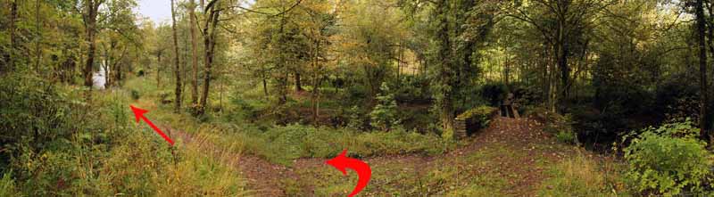
Look for a turning right and the remains of a vandalised bridge.
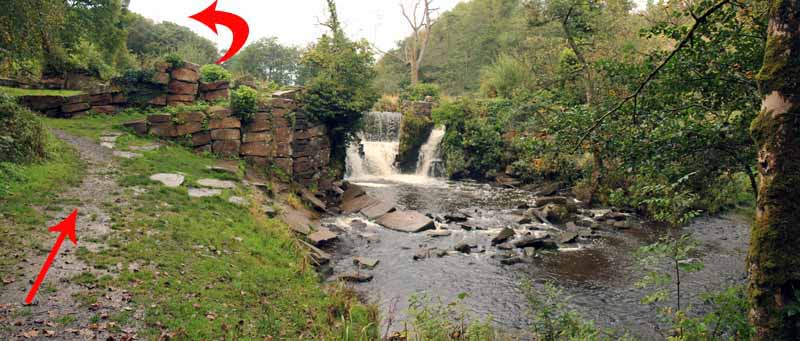
Turn left along the river path and arrive at the man-made water fall.
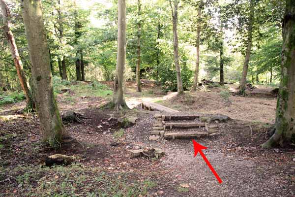
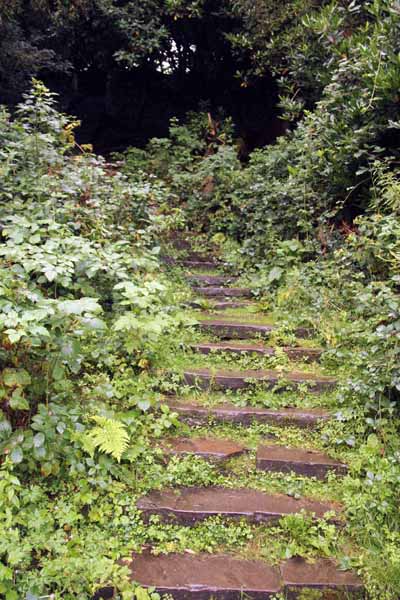
Rejoin the broad track behind the falls and continue past stone steps that mark the remains of the old demolished mansion.
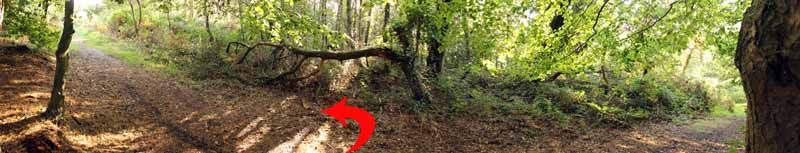
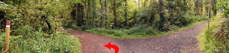
Follow the broad track and turn right when it meets another path at a T-junction.
Go past the visitor centre and turn left to exit the woods at the start point.


Ramblers Cymru and Swansea Ramblers provide these routes but accept no responsibility for those walking them.

If you would like to go on a walk but would prefer to do so with a group of people then click on our Programme section to see what walks we are leading.

We have walks for varying levels of ability and you get the chance to see the countryside in places you might never go by yourself!


Maps of the Walk


Ordnance Survey map of the route to walk
Resizable and draggable
(Can be reset to original dimensions by refreshing the page)
Green Swansea Ramblers logo markers where present can be clicked to provide more information


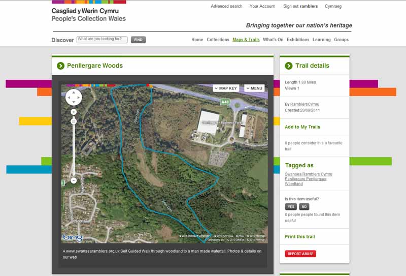
This aerial map is resizable and draggable
(Can be reset to original dimensions by refreshing the page)

A 25,000 Ordnance Survey map of the area
can be viewed by clicking on the above 'View Larger Map' option
(applies only if the above is a Bing map, not a Google map )


Peoples Collection link

The route of this walk has been added to The National Museum of Wales' Peoples Collection Web site.
A choice of aerial imagery or historic Ordnance Survey mapping is available.
Click the map to enter their web site (opens in a new browser window)
or copy and paste this link into a new browser window.
http://www.peoplescollectionwales.co.uk/Trail/758-penllergare-woods


Photographs of the Walk


Photograph of Walking Route - Image 1
The A48 lay-by just east of the Penllergaer M4 junction (Junction 47)


Photograph of Walking Route - Image 2
Enter the woodland directly from the A48 then take the left turn onto the woodland walk


Photograph of Walking Route - Image 3
Follow the laid out path


Photograph of Walking Route - Image 4


Photograph of Walking Route - Image 5


Photograph of Walking Route - Image 6
Continue through the woodland


Photograph of Walking Route - Image 7
Turn left at this junction


Photograph of Walking Route - Image 8
Woodland canopy opens up


Photograph of Walking Route - Image 9
Power lines along the way. Watch for the next ridge above Hendrefoilan


Photograph of Walking Route - Image 10
Look out for the wooden post that marks the left turn


Photograph of Walking Route - Image 11
Turn left into the woods


Photograph of Walking Route - Image 12
Follow the well walked path


Photograph of Walking Route - Image 13
Join this track and turn left then go right and descend


Photograph of Walking Route - Image 14
Descend to the next junction


Photograph of Walking Route - Image 15
Turn left at the junction


Photograph of Walking Route - Image 16
Follow the broad track for some way


Photograph of Walking Route - Image 17
Either climb over the barrier on the Sapper Bridge or descend left to the other bridge


Photograph of Walking Route - Image 18
The other bridge just below the first


Photograph of Walking Route - Image 19
Turn right to reach to the other side of the Sapper Bridge


Photograph of Walking Route - Image 20
Go through the gate


Photograph of Walking Route - Image 21
Follow this path for some while


Photograph of Walking Route - Image 22
At the junction descend to a ruined bridge but turn left rather than cross it !


Photograph of Walking Route - Image 23
A few yards ahead is the man-made falls


Photograph of Walking Route - Image 24
The falls (see the video at the end of the photographs)


Photograph of Walking Route - Image 25
Return to the broad track and continue towards the start


Photograph of Walking Route - Image 26
The upper lake is overgrown


Photograph of Walking Route - Image 27
Pass by these steps which are the remains of the mansion


Photograph of Walking Route - Image 28
At the junction of the paths turn right


Photograph of Walking Route - Image 29
The photographic panorama gives a distorted view of the straight path


Photograph of Walking Route - Image 30
Go past the visitor centre


Photograph of Walking Route - Image 31
Turn left back to the A48


Video: The man-made falls in Penllergare Woods
Duration 0m 15s


More information about walking in Wales is available at:    www.ramblers.org.uk/wales

Ramblers Cymru and Swansea Ramblers provide this route but accept no responsibility for those walking it

All photographs Copyright 2012 Andrew Morgan. All rights reserved


Swansea Ramblers hope you enjoy doing this walk.

Over time things can change on the walk

- for example - path diversions, new gates instead of stiles or maybe the path has become blocked.

If you do find anything different on the way then let us know:

1. Which walk you have been on.

2. The type and location of the change or the problem you have experienced.


Of course you may just like to tell us that you have done the walk and whether you enjoyed it.

Use the link below to email us about your walk.

We'll look forward to hearing from you.


If the email link is not displayed above or is not supported by your email setup, manually type in our email address
address


Back to top

Our use of Cookies

Our Privacy Policy


Valid HTML 4.01 Transitional