October
|
Saturday 24th October |
Cowbridge and Llansannor Cancelled due to rain |
|
Saturday 24th October |
Swansea Marina in the rain!
|
||||||||
|
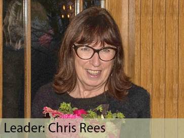
Leader: Andrew Morgan |
4-5 miles |
||||||||
|
Tel: 07719-409504 |
Easy |
||||||||
|
|
|
||||||||
|
|
|
||||||||
|
Description:
A level walk around the Marina with a stop at a venue for coffee and an optional meal after the walk.
Storms Austen and Boelo are bringing rain for Saturday so our Cowbridge walk has been rescheduled for Saturday 5th December.
Instead, we will visit the Marina with options to drop out or cut short the walk if the rain is too bad.
We will walk from the Guildhall and brave the wet conditions of the promenade to head east towards the Civic Centre.
Heading inland away from the breezes on the coast, we’ll walk alongside the old South Dock which became the Marina in the 1980s.
We will make our way to a suitable venue close to the Tawe where we can purchase a coffee in the dry before venturing again into the rain.
We’ll have an optional one-mile extension along the Princess of Wales Dock before returning to the Tawe,
OR if the weather is really bad, just make our way back via the Marina to the Bay View where we can have an optional Thai Meal (in the dry!!). ___________________________
Dogs: To remain on short, non-extendible leads Livestock: None. Stiles: None. Toilets: Bay View Hotel, Marina, Sainsburys. Terrain: Level, mostly on hard surfaces. ___________________________
Social after walk: Afterwards, we will go for refreshments to The Bay View Hotel. ___________________________
|
|||||||||
|
Start: |
Starting Place: |
|
|||||||
|
11:00 a.m. |
Swansea: Guildhall: Francis Street: On-street parking (Free). |
||||||||
|
___________________________
Directions: · Guildhall is located west of city centre, just north of Oystermouth Road. · Francis Street is on the western side of Guildhall, opposite Victoria Park. · Additional parking is available in Guildhall Road North. ___________________________
|
|||||||||
|
(Members can use the FREE Ramblers App as a Sat Nav to all our walks) |
|||||||||
|
What3Words: super.apron.player |
Post Code: SA1 4PE |
||||||||
|
Lat/Long: 51.6134, -3.9614 |
|
GR: |
SS |
642 923 |
|||||
|
Sunday 25th October |
Greenwich Mean Time: Clocks go back
|
|
Thursday 29th October |
Penclawdd A Taste of Gower Walk |
||||||||
|
Leader: Al Evans |
4 miles |
||||||||
|
Tel: 07791-408184 |
Moderate |
||||||||
|
|
|
||||||||
|
|
|
||||||||
|
Description:
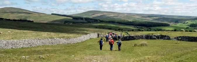
A lovely walk on North Gower with beautiful views over Loughor Estuary to Llanelli and Burry Port.
We will walk from Penclawdd to Hermon Chapel and back. ___________________________
Dogs: To remain on short, non-extendible leads Livestock: None. Stiles: None. Toilets: In GG’s | Public Toilets near car park. Terrain: Ascents and descents on narrow paths. ___________________________
Social after walk: Afterwards, we will go for refreshments to GG’s Café & Ice-cream Parlour. ___________________________
|
|||||||||
|
|
|||||||||
|
|
|||||||||
|
The view from above Penclawdd across Loughor Estuary |
|||||||||
|
Start: |
Starting Place: |
|
|||||||
|
11:00 a.m. |
|||||||||
|
___________________________
Directions: · From Gowerton, follow B4295 westward to Penclawdd. · Negotiate the double bend in the village. · Pass over the pedestrian crossing. · Turn immediately right into the car park. (The Chip shop is to the left and GGs is to the right). ___________________________
|
|||||||||
|
(Members can use the FREE Ramblers App as a Sat Nav to all our walks) |
|||||||||
|
What3Words: pining.skillet.area |
Post Code: SA4 3YF |
||||||||
|
Lat/Long: 51.6429, -4.1038 |
|
GR: |
SS |
545 958 |
|||||
|
Thursday 29th October |
Oystermouth Castle A Guided Ghost Tour |
||||||||
|
|
|
||||||||
|
Description:
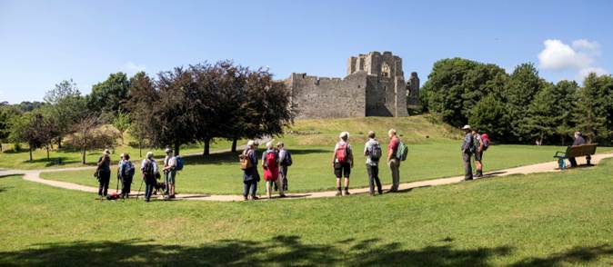
The Social Committee has arranged a Ghost Tour of Oystermouth Castle just before Halloween!
We will have a tour of the castle which is said to be haunted. The tour will last between 90 minutes to 2 hours.
Members will have been emailed details on how to book.
Maximum Number: 20 Cost: £6 (Usually £14)
|
|||||||||
|
N.B. You must book in advance your place on the tour |
|||||||||
|
|
|||||||||
|
|
|||||||||
|
|
|||||||||
|
Start: |
Starting Place: |
|
|||||||
|
7:00 p.m. |
Oystermouth Castle: Castle gates |
||||||||
|
What3Words: stuff.nerves.examine |
Post Code: SA3 4BH |
||||||||
|
Lat/Long: 51.5768, -4.0024 |
|
GR: |
SS |
613 883 |
|||||
|
Saturday 31st October |
Crynant Forest |
||||||||
|
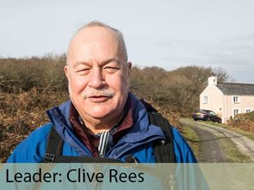
Leader: Clive Rees |
6 miles |
||||||||
|
Tel: 07969-378750 |
Moderate |
||||||||
|
|
|
||||||||
|
|
|||||||||
|
Description:
Enjoy a walk through Crynant Forest with a high-level panorama at the top.
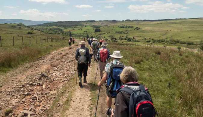
There will be a steep, rough ascent/descent at the start/finish but we’ll have great views of the Black Mountain, walking mostly on forestry tracks.
The walk includes a short introduction to some lovable bloodhounds! ___________________________
Click to see more photographs of a previous walk in this area. ___________________________
Dogs: To remain on short leads Stiles: None. Toilets: At the kennels. Terrain:
___________________________
Social after walk Afterwards, we will go for refreshments to The Gradon Country Pub. ___________________________
|
|||||||||
|
|
|||||||||
|
The viewpoint above Crynant |
|||||||||
|
|
|||||||||
|
The forestry paths above the kennels |
|||||||||
|
|
|||||||||
|
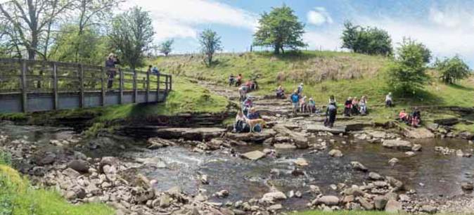
Relaxing after the walk on one of our regular post-walk socials |
|||||||||
|
Start: |
Starting Place: |
|
|||||||
|
11:00 a.m. |
Crynant: Ty Cornel Kennels
|
||||||||
|
___________________________ Directions: · Head to M4 Jct 43 at Llandarcy. · Join A465. · At Aberdulais, leave A465 to join A4109. · Drive through Crynant on A4109. · Take the road marked Ystradgynlais. · You will reach an area of common land. · Continue in this open area. · Do NOT go as far as the trees at the end of the common. · Pass two isolated houses set off on the left. · Take the next left turn by a Telegraph Pole. · Go along a rough track which has no sign for the kennels. · There is a Rifle Range on the right, opposite the kennels. · On the left is the Banwen Miners’ Bloodhounds Kennels. · Enter via a set of double gates. · If full, the overspill is a little further up the track. ___________________________
|
|||||||||
|
(Members can use the FREE Ramblers App as a Sat Nav to all our walks) |
|||||||||
|
What3Words: winds.thorax.trips |
Post Code: SA10 8PR |
||||||||
|
Lat/long: 51.7514, -3.7597 |
|
GR: |
SN |
786 073 |
|||||