July
|
Rescheduled for Thursday |
|||
|
Wednesday 15th July |
An Evening Walk: Morfa Countryside An Introduction to walking with us |
||
|
Leader: David Kealaher |
4 miles |
||
|
Tel: 07542 769421 |
Leisurely |
||
|
|
|
||
|
|
|
||
|
PLEASE NOTE: The day for this walk has changed to avoid a clash with the international Football match |
|||||||||||
|
Thursday 16th July |
An Evening Walk: Morfa Countryside An Introduction to walking with us |
||||||||||
|
Leader: David Kealaher |
4 miles |
||||||||||
|
Tel: 07542 769421 |
Leisurely |
||||||||||
|
|
|
||||||||||
|
|
|
||||||||||
|
Description:
An evening walk in the countryside surrounding the Enterprise Park.
On our way, we pass through woodland and see two picturesque lakes.
We’ll follow some of the Active Travel Paths as we make our way towards Morrisons and over to Pluck Lake.
We’ll head north through the woodland until we reach the area near Tesco’s. Our return then takes us back on other paths back to the start.
Stiles: None. Toilets: In pub after walk. Terrain: Mostly flat on Active Travel Paths and other surfaces.
Social after walk: Afterwards, we will go for refreshments to The Harvester by the Stadium. |
|||||||||||
|
|
|||||||||||
|
|
Dogs remain on short leads |
||||||||||
|
Start: |
Starting Place: |
|
|||||||||
|
6:30 p.m. |
Morfa: Beaufort Road: Bank opposite T. Rex model at Days Motor Park |
||||||||||
|
Directions: · From City Centre, head north and join A4067. · Continue on A4067 past the stadium. · Take 4th exit off roundabout to continue on A4067 (Ffordd Cwm Tawe). · Take slip road to the right, signed Enterprise Park (Beaufort Road). · At lights, cross the southbound carriageway onto Beaufort Road. · Descend and bear left. · Park near Days Motor Park (on-street parking).
|
|||||||||||
|
(Members can use the FREE Ramblers App as a Sat Nav to all our walks) |
|||||||||||
|
What3Words: adults.call.fool |
Post Code: SA6 8HR |
||||||||||
|
Lat/Long: 51.6524, -3.9247 |
|
GR: |
SS |
669 966 |
|||||||

|
Saturday 18th July |
Mynydd Gellionnen
|
|||||||||
|
Leader: Mike Clarke |
6 miles |
|||||||||
|
Tel: 01792-843590 |
Moderate |
|||||||||
|
|
|
|||||||||
|
|
|
|||||||||
|
Description:
A walk onto the hillside above Craig Cefn Parc with lovely views.
Our walk will follow the beautiful Lower Clydach River before ascending Craig yr Allt with panoramic views of the surrounding countryside.
We will pass Gellionnen Chapel which was built by Protestant dissenters in 1692 and is now a Unitarian meeting place.
We then walk over the northern part of Mynydd Gellionen.
From Mynydd Gellionnen, our walk returns to our starting point via a section of the Cwm Clydach Trail.
Stiles: Three stiles. Toilets: None. Terrain: Uneven ground on open hillside with one steep climb.
Social after walk: Afterwards, we will go for refreshments to The Globe Inn at Glais. |
||||||||||
|
|
||||||||||
|
|
Dogs remain on short leads |
|||||||||
|
Start: |
Starting Place: |
|
||||||||
|
11:00 a.m. |
Craig Cefn Parc: RSPB Reserve Car Park |
|||||||||
|
Directions: · From M4 J45 Ynysforgan, head north on A4067 to Glais Roundabout. · Take 1st exit onto B4291 to Clydach. · Cross 1st mini roundabout, signed Craig Cefn Parc. · At 2nd mini roundabout, take 2nd exit, signed Craig Cefn Parc. · Continue 1 mile on Vadre Road/Lone Road · N.B. After passing the New Inn (on the right) - · Bear left to cross the bridge · Immediately turn right into the long narrow parking area.
|
||||||||||
|
(Members can use the FREE Ramblers App as a Sat Nav to all our walks) |
||||||||||
|
What3Words: residual.nags.hospitals |
Post Code: SA6 5SY |
|||||||||
|
Lat/Long: 51.7065, -3.9068 |
|
GR: |
SN |
683 026 |
||||||
|
Saturday 18th July |
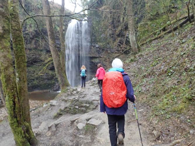
Henrhyd Falls Cancelled due to Path deterioration See replacement walk above
|
|
Sunday 19th July |
Cefn Cribwr Roundabout |
|||||||||
|
Leader: Tim Gronow |
9 miles |
|||||||||
|
Tel: 07710-231630 |
Moderate |
|||||||||
|
|
|
|||||||||
|
Description:
A woodland and farmland walk around Cefn Cribwr.
Social after walk: Afterwards, we will go for refreshments to a suitable venue. |
||||||||||
|
|
||||||||||
|
|
Assistance Dogs Only |
|||||||||
|
Start: |
Starting Place: |
|
||||||||
|
10:00 a.m. |
Pyle: Cefn Cribwr Rugby Club Car Park |
|||||||||
|
Directions: · Follow M4 eastward · At J37 (Pyle), take 1st exit off slip road onto A4229 northward. · At roundabout, take 2nd exit to Pyle. · At 2nd set of traffic
lights (at cross roads), turn right onto B4281, · Watch for speed camera. · After about 2 miles, turn right into car park.
|
||||||||||
|
What3Words: outpost.assess.buzzards |
Post Code: CF32 0BA |
|||||||||
|
Lat/Long: 51.5313, -3.6421 |
|
GR: |
SS |
861 826 |
||||||
|
Wednesday 22nd July |
The Top Paths – Bishopston, Holtsfield, Caswell Valley |
||||||||||
|
Leader: Clive Scott |
6 miles |
||||||||||
|
Tel: 07367-299198 |
Moderate |
||||||||||
|
|
|
||||||||||
|
|
|
||||||||||
|
Description:
A coastal and inland walk with fine views.
The South Gower Rugby Club have kindly given us permission to park in their private car park.
The walk passes through the attractive village of Bishopston and across Holts Field with its open views over the surrounding countryside.
The route then follows the upper path through Caswell Valley where woodland and wildlife provide a peaceful backdrop.
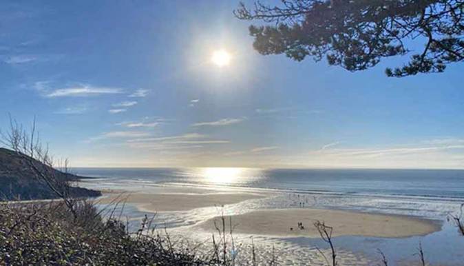
Reaching the clifftops, the coastal path offers impressive views across the bay and along the rugged Gower coastline. _________________________________________
Lunch A descent into Caswell Bay provides an ideal stop for lunch by the sea. _________________________________________
The return journey follows the upper path above Brandy Cove. This combines dramatic coastal scenery with quiet natural surroundings.
We then continue through countryside to our starting point.
Stiles: None. Toilets: Caswell Bay. Terrain: · Undulating paths, especially by the coast (and in places rough). · Some ascent. · This walk is unsuitable for young children. · Several sets of steps including one long descent and one long ascent.
Social after walk: Afterwards, we will go for refreshments to the Joiners in Bishopston.
|
|||||||||||
|
|
|||||||||||
|
Walking across Caswell Bay |
|||||||||||
|
The view from the coast path |
|||||||||||
|
|
|||||||||||
|
|
Dogs remain on short leads |
||||||||||
|
Start: |
Starting Place: |
|
|||||||||
|
10:00 a.m. |
Bishopston: Pyle Corner: South Gower Rugby Club (Free) |
||||||||||
|
Directions: · From Swansea, follow A4067 towards Mumbles. · At Blackpill, turn right to ascend the Mayals (B4436). · Continue straight on for 2 miles. · Pass Northway Filling Station. · Descend and turn left at the junction for Bishopston. · Follow this village road for just under a mile to Pyle Corner. · Turn 2nd right at the bend in the road at Pyle Corner. · Head west on Pwlldu Lane. · After 400 feet, turn left at the junction to follow a single-track lane. · Turn right in just under a quarter of a mile at the Rugby Club.
|
|||||||||||
|
(Members can use the FREE Ramblers App as a Sat Nav to all our walks) |
|||||||||||
|
What3Words: congas.birdcage.isolated |
Post Code: SA3 3DX |
||||||||||
|
Lat/Long: 51.5725, -4.0520 |
|
GR: |
SS |
578 879 |
|||||||
|
23rd July |
Please note the change of day for this walk An Evening Walk: Panoramic views from Mount Pleasant (Note earlier start time for optional post-walk meal!) An Introduction to walking with us |
|||||||||
|
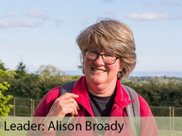
Leader: Alison Broady |
3 miles |
|||||||||
|
Tel: 07926-285806 |
Moderate Sunset is at 9:19 p.m. |
|||||||||
|
|
|
|||||||||
|
|
|
|||||||||
|
Description:
At 5:30 p.m., enjoy an evening stroll with Alison through the Mount Pleasant area above the city centre.
The walk will include Rosehill Quarry, Mayhill Washing Lake and the Jewish Cemetery, plus some surprises.
Stiles: There are no stiles on this walk. Toilets: At food hall after the walk. Terrain: Ascent of hills above centre of Swansea but with some great views.
Social after walk: Afterwards we will go for food at the ALBERT HALL Food Hall where you can select food from a number of outlets, including Pizza Boyz Pizzas.
Those who came to their other venue last year really enjoyed their meals!
No need to let Alison know you are coming, just turn up and we’ll order food on the day.
|
||||||||||
|
|
||||||||||
|
View from Mount Pleasant |
||||||||||
|
|
||||||||||
|
|
||||||||||
|
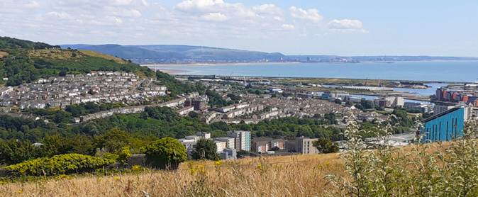
View towards Port Talbot |
||||||||||
|
|
Dogs remain on short leads |
|||||||||
|
Start: |
Starting Place: |
|
||||||||
|
5:30 p.m. |
Craddock Street: Albert Hall Foodhall |
|||||||||
|
Directions: · Located on the corner of Cradock St. and Walter’s Road. · Nowhere close to park on-street. · On-road parking further west on Walter Road. · N.B. One-hour parking applies in some parking bays until 6 p.m.
|
||||||||||
|
(Members can use the FREE Ramblers App as a Sat Nav to all our walks) |
||||||||||
|
What3Words: costs.doors.chew |
Post Code: SA13EN |
|||||||||
|
Lat/Long: 51.6213, -3.9474 |
|
GR: |
SS |
652 931 |
||||||

|
Saturday 25th July |
Leader Required
|
|
If one of our leaders could lead a walk on this day, please let us know.
Please note this is the day of the Air Show.
|
|
|
Thursday 30th July |
Penllergare Valley Woods A Taste of Gower Walk |
|||||||||
|
Leader: Lynne Esson |
3-4 miles |
|||||||||
|
Tel: 07754-435221 or 01792-845845 |
Leisurely |
|||||||||
|
|
|
|||||||||
|
|
|
|||||||||
|
Description:
From the car park, we will walk round the valley and woodland, alongside the river and the two lakes.
We will have some lovely views over the valley from the viewpoint.
This walk will take between 2 and 3 hours.
Stiles: None. Toilets: Coffee Shop area. Terrain:
Social after walk: Afterwards, we will go for refreshments into the Coffee shop.
|
||||||||||
|
|
Dogs remain on short leads |
|||||||||
|
Start: |
Starting Place: |
|
||||||||
|
10:30 a.m. |
Penllergaer: Penllergare Valley Woods car park (Pay & Display) |
|||||||||
|
Directions: · Take the A483 Carmarthen Road to J46 of M4. · Go around the roundabout. · Exit onto A48 (eastbound), signposted Morriston / Llangyfelach. · Take the first turning right, signposted for the woods. · Turn left into the car park (Pay & Display).
|
||||||||||
|
(Members can use the FREE Ramblers App as a Sat Nav to all our walks) |
||||||||||
|
What3Words: trial.stay.pays |
Post Code: SA4 9GS |
|||||||||
|
Lat/Long: 51.6746, -3.9925 |
|
GR: |
SS |
623 991 |
||||||