March
|
Wednesday 11th March |
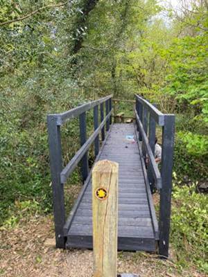
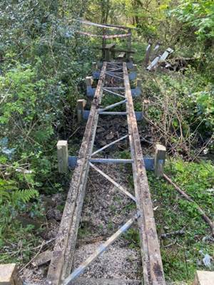
Path Maintenance Team Come and help us keep the paths open to walk |
|
|
Coordinator: Clive Scott |
|
|
|
Tel: 07369-299198 |
|
|
|
Email: path.maintenanceATswansearamblers.org.uk (N.B. Replace ‘AT’ with @) |
||
|
|
|
|
|
|
|
|
|
|
||
|
Description: On or around the 2nd Wednesday of each month, we assist the City & County of Swansea to maintain the network of footpaths.
The actual day we go out will depend on the work schedule of the council’s Countryside Access Team.
Our volunteer work may include everything from pruning and strimming to stile repairs and bridge building.
All are welcome to take part, so if you are interested in becoming a volunteer with our team, please contact the coordinator to find out more information. |
||

|
Thursday 12th March |
SA1 Wellbeing Walk |
||||||||||
|
Leader: Lynne Esson |
Up to 1 hour |
||||||||||
|
Tel: 07754-435221 or 01792-845845 |
Easy Access |
||||||||||
|
|
|
||||||||||
|
|
|
||||||||||
|
Description:
Another monthly ‘Wellbeing Walk’
The walk is very short and is measured by time and not distance.
From Sainsbury’s we will walk over the Sail Bridge and round the Marina.
Social after walk: Afterwards, we will go for refreshments into Sainsbury’s for a coffee/tea.
|
|||||||||||
|
|
Dogs remain on short leads |
||||||||||
|
Start: |
Starting Place: |
|
|||||||||
|
10:00 a.m. |
SA1: Sainsburys Car Park - rear entrance of coffee shop |
||||||||||
|
(Members can use the FREE Ramblers App as a Sat Nav to all our walks) |
|||||||||||
|
What3Words: lonely.fence.soda |
Post Code: SA1 8JA |
||||||||||
|
Lat/Long: 51.6201, -3.9344 |
|
GR: |
SS |
661 930 |
|||||||

|
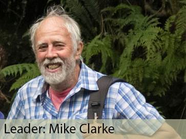
Saturday 14th March |
Pennard |
||||||||||
|
Leader: Andrew Morgan |
6 miles (Two walks: 2.5 and 3.5 miles) |
||||||||||
|
Tel: 07719-409504 |
Leisurely |
||||||||||
|
|
|
||||||||||
|
|
|
||||||||||
|
Description:
A figure of eight walk in a scenic area where, if you choose, you could join us at the car park around 12:45 p.m. for the second half.
(Let me know if you intend to meet us for the second half of the walk). The afternoon walk may start a little later if the morning overruns.
The first section of this walk is about 2.5 miles and will circle around the edge of the Golf course.
Reaching the viewpoint over Three Cliffs Bay, we’ll follow the coast path to Pennard Castle. From there we will pass the landmark water tower on our way across the common and back to the start.
Our lunch stop will be at the recently created community garden adjacent to the cars (but given the ongoing forecast of showers, we could have lunch in our cars).
The afternoon walk is about 3.5 miles and will pass through fields behind the school. Here stiles have been replaced by gates to make it much easier for people to enjoy the path.
Walking through woodland, we then cross fields and a farm track. We’ll then make our way to the coast path and enjoy more views over the Bristol Channel.
We’ll walk west along the coast before turning inland to once more come close to the golf course and return to the start.
Stiles: None. Toilets: Pennard Cliff-Top Car Park. Terrain: Sandy, muddy, gentle ascents. Walking poles recommended.
Social after walk Afterwards we will go for refreshments to The Beaufort in Kittle.
|
|||||||||||
|
|
Dogs remain on short leads |
||||||||||
|
Start: |
Starting Place: |
|
|||||||||
|
11:00 a.m. |
Pennard: School Car Park (Free) |
||||||||||
|
Directions: · From Swansea, head south on A4067, Oystermouth Road. · Turn right to ascend B4436, Mayals Road (after The Woodman Inn). · Follow B4436 through Kittle. · Continue straight on at junction where B4436 turns right. · Follow road to 20 MPH & School signs. · Turn left into school car park before the pedestrian crossing.
|
|||||||||||
|
(Members can use the FREE Ramblers App as a Sat Nav to all our walks) |
|||||||||||
|
What3Words: prompts.grid.innovate |
Post Code: SA3 2DR |
||||||||||
|
Lat/Long: 51.5758, -4.0872 |
|
GR: |
SS |
554 883 |
|||||||
|
|
|||||||||||
|
|
|||||||||||
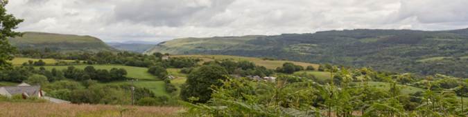
|
The Cliffs at Pennard |
|||||||||||
|
|
|||||||||||
|
Three Cliffs Bay |
|||||||||||
|
|
|||||||||||

|
Wednesday 18th March |
The Down – Rhosili
|
||||||||||||
|
Leader: Clive Scott |
5 miles |
||||||||||||
|
Tel: 07369-299198 Email: clive.scott1@icloud.com |
Moderate |
||||||||||||
|
|
|
||||||||||||
|
Description:
This must be one of the most beautiful walks for stunning views!
We will walk through the village of Rhosili then cross the fields towards Middleton.
We then join The Gower Way which is the most gradual route to the top of the Down.
With some of the best views on Gower, we’ll walk along the Down then descend to Hillend.
Our return will follow the coast path back to Rhosili.
Public Transport: · Bus 118 (check bus times before travel). · Depart 9:05 a.m. Swansea Quadrant Bus Station. · Arrive 10:03 a.m. Rhosili.
Stiles: None. Toilets: In Rhosili. Terrain: · Paths are well established with just the occasional bit of mud. ·
Descent to Hillend is quite steep
in parts · There may be a few sheep and horses along the route.
Social after walk: Afterwards, we will go for refreshments to a local venue.
|
|||||||||||||
|
|
Dogs remain on short leads |
||||||||||||
|
Start: |
Starting Place: |
|
|||||||||||
|
10:30 a.m. |
Rhosili: National Trust Car Park (Pay and display, free to NT members).
As you drive to and from the walk, please pass Gower’s free roaming animals wide (2 metres) and slow (10mph). Thank you!
|
||||||||||||
|
Directions: · Head west into Gower on A4118. · Pass through Knelston and follow sharp left-hand bend to Scurlage. · Turn right in Scurlage, signposted Rhosili. · Drive to the end of the road in Rhosili Village. · Car park is at the end of the road.
|
|||||||||||||
|
(Members can use the FREE Ramblers App as a Sat Nav to all our walks) |
|||||||||||||
|
What3Words: important.martini.unleashed |
Post Code: SA3 1PR |
||||||||||||
|
Lat/Long: 51.5690, -4.2897 |
|
GR: |
SS |
415 880 |
|||||||||
|
Saturday 21st March |
Cwm Clydach Valley and Mynydd Gelliwastad
|
|||||||||
|
Leader: Paul Scutchings |
6 miles |
|||||||||
|
Tel: 07725-856484 |
Moderate Ascent: 900ft / 275m |
|||||||||
|
|
|
|||||||||
|
Description:
Weather permitting, we will have great views on this walk.
Initially, we’ll complete a 2-mile circular walk of Cwm Clydach, (via Cathelyd uchaf), descending into the Clydach Valley.
From the valley, we’ll ascend to Craig-cefn-parc for our 1st break.
Following paths through Craig-cefn-parc, we’ll take a route that eventually arrives at the summit of Gelliwastad and the Trig Point.
On a good day, the views are excellent!!
We will descend via Graig Felen into Clydach, joining the old, tarmacked rail route back to the start point.
A 2nd break will be taken at a suitable point.
NOTE. If the weather is unkind, the walk route will be shortened to 4 miles.
Stiles: One. Toilets: None. Terrain:
Social after walk: After the walk we will visit The Millers Arms, Ynystawe.
|
||||||||||
|
|
Assistance Dogs Only |
|||||||||
|
Start: |
Starting Place: |
|
||||||||
|
11:00 a.m. |
Craig Cefn Parc: RSPB Reserve Car Park |
|||||||||
|
Directions: · From M4 J45 Ynysforgan, head north on A4067 to Glais Roundabout. · Take 1st exit onto B4291 to Clydach. · Cross 1st mini roundabout, signed Craig Cefn Parc. · At 2nd mini roundabout, take 2nd exit, signed Craig Cefn Parc. · Continue 1 mile on Vadre Road/Lone Road · N.B. After passing the New Inn (on the right) - · Bear left to cross the bridge · Immediately turn right into the long narrow parking area.
|
||||||||||
|
(Members can use the FREE Ramblers App as a Sat Nav to all our walks) |
||||||||||
|
What3Words: residual.nags.hospitals |
Post Code: SA6 5SY |
|||||||||
|
Lat/Long: 51.7065, -3.9068 |
|
GR: |
SN |
683 026 |
||||||
|
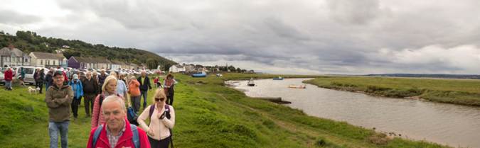
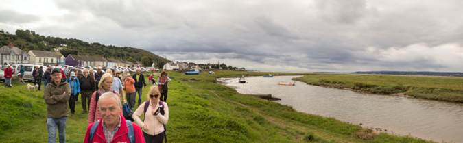
Sunday 22nd March |
3 Cliffs and 3 Kings
|
||||||||||
|
Leader: Mary Williams |
10.5 miles |
||||||||||
|
Tel: 07743-347777 |
Moderate |
||||||||||
|
|
|
||||||||||
|
|
|
||||||||||
|
Description:
A repeat attempt to complete this circular walk visiting landmarks associated with 3 of our kings. (Unfortunately, the walk on 4th January was hampered by icy conditions underfoot!).
Starting from Southgate Car Park, we will walk to the Pennard Garden Society Wellness Garden where a tree has been planted to commemorate the coronation of King Charles III.
From there, we walk via the summit of Cefn Bryn to a memorial which celebrates the opening by (the then) Prince Charles of The Gower Way Long Distance Path.
We will continue to King Arthur's Stone which is believed to have been visited by King Henry VII’s army on their way to victory at Bosworth.
Our last landmark will be the King Arthur Hotel. We then return to Southgate car park via Cefn Bryn and along the coastal path, passing Great Tor.
Social after walk: Afterwards, we will go for refreshments to the Southgate Club. |
|||||||||||
|
|
|||||||||||
|
|
Dogs remain on short leads |
||||||||||
|
Start: |
Starting Place: |
|
|||||||||
|
10:00 a.m. |
Southgate: Pennard Cliffs: National Trust
Car Park (Charge) |
||||||||||
|
Directions: · From Swansea, head south on A4067, Oystermouth Road · Turn right to ascend B4436, Mayals Road (after The Woodman Inn) · Follow B4436 through Kittle · Continue straight on at junction where B4436 turns right · Follow road through Southgate Village to roundabout · Park in the cliff-top car park
|
|||||||||||
|
(Members can use the FREE Ramblers App as a Sat Nav to all our walks) |
|||||||||||
|
What3Words: zaps.navigate.tripled |
Post Code: SA3 2DJ |
||||||||||
|
Lat/Long: 51.5670, -4.0878 |
|
GR: |
SS |
553 874 |
|||||||

|
Wednesday 25th March |
West Cross to the Pier (and back!)
|
||||||||||
|
Leader: Ken Rees |
4 miles |
||||||||||
|
Tel: 07982-790853 |
Easy Access |
||||||||||
|
|
|
||||||||||
|
|
|
||||||||||
|
Description:
A gentle walk on easy surfaces, providing an introduction to walking with Swansea Ramblers.
This will be a leisurely 4-mile walk along the promenade from West Cross Inn to the Pier and back.
There will be lovely views across Swansea Bay.
Stiles: None Toilets: Oystermouth Square | Knab Rock Terrain: Level walking, no hills. Good surfaces, mostly tarmacadam.
Social after walk: Afterwards, we will go for refreshments to The West Cross Inn. |
|||||||||||
|
|
|||||||||||
|
|
Dogs remain on short leads |
||||||||||
|
Start: |
Starting Place: |
|
|||||||||
|
11:00 a.m. |
West Cross: Parking on opposite side of road from West Cross Inn (Free) |
||||||||||
|
Directions: · From Swansea, follow the coast road (A4067) through Blackpill. · Take 2nd exit at mini roundabout in West Cross. · Take 1st left onto West Cross Lane. · Almost immediately, turn 1st left into Alderwood Road. · Follow road past shops to free car park. · (Additional on-street parking available off West Cross Lane).
|
|||||||||||
|
(Members can use the FREE Ramblers App as a Sat Nav to all our walks) |
|||||||||||
|
What3Words: ideal.highs.strain |
Post Code: SA3 5JD |
||||||||||
|
Lat/Long: 51.5860, -4.0010 |
|
GR: |
SS |
614 893 |
|||||||
|
Thursday 26th March |
Lliw Valley A Taste of Gower Walk |
|||||||||
|
Leader: Lynne Esson |
4 miles |
|||||||||
|
Tel: 07754-435221 or 01792-845845 |
Leisurely |
|||||||||
|
|
|
|||||||||
|
|
|
|||||||||
|
Description:
From the car park, we will walk to the upper reservoir. We then return down the same road until we get to some steps. Here we will descend and walk around the back of the lower reservoir.
This walk will take between 2 and 3 hours.
Stiles: None Toilets: At the car park Terrain: Mainly tarmac but could be a little muddy at the lower reservoir.
Social after walk: Afterwards, we will go for refreshments into the café (which should now have reopened). |
||||||||||
|
|
Dogs remain on short leads |
|||||||||
|
Start: |
Starting Place: |
|
||||||||
|
10:30 a.m. |
Felindre: Lliw Reservoir car park (N.B. Card payment ONLY)
|
|||||||||
|
Directions: · Leave M4 at J46 and head towards Felindre. · Before descending into the village, turn right, signposted Lliw Reservoir. · Continue this road for approximately 1 mile then turn left. · Follow this road to the end - then park.
|
||||||||||
|
(Members can use the FREE Ramblers App as a Sat Nav to all our walks) |
||||||||||
|
What3Words: gates.undertook.pitching |
Post Code: SA5 7NA |
|||||||||
|
Lat/Long: 51.7128, -3.9557 |
|
GR: |
SN |
649 033 |
||||||
|
Saturday 28th March |
Mynydd Drumau
|
||||||||||
|
Leader: David Kealaher |
5 miles |
||||||||||
|
Tel: 07542-769421 |
Moderate Ascent: 800 ft / 243 m |
||||||||||
|
|
|
||||||||||
|
|
|
||||||||||
|
Description:
From the main road, we will cross by Swiss Cottage and proceed up a lane.
We will join the Bridle path which winds gradually up onto the top of Drumau Mountain. Here we will see Careg Bica, the ancient Standing Stone.
We will follow the ridge to the Trig Point where commanding views can be seen over the Neath Valley.
The walk will then descend through woodland paths to return to the start point.
Stiles: There are two stiles on the walk. Toilets: In the Glyn Clydach after the walk. Terrain: There will be an ascent of the hillside.
Social after walk: Afterwards, we will go for refreshments to The Loft Bar, Glyn Clydach Hotel. |
|||||||||||
|
|
|||||||||||
|
|
Dogs remain on short leads |
||||||||||
|
Start: |
Starting Place: |
|
|||||||||
|
11:00 a.m. |
Neath Abbey: Glyn Clydach Hotel (Car share where possible) |
||||||||||
|
Directions: · Follow A465 to the Neath exit. · At roundabout, take 1st exit onto A474. · At next roundabout, take 1st exit onto A4230. · At a double mini roundabout, turn right uphill on Longford Road. · After 1 mile, turn right into hotel car park at sign for Glyn Loft · Park on left before reaching the main car park of the venue.
|
|||||||||||
|
(You can use the Ramblers App as a Sat Nav to all our walks) |
|||||||||||
|
What3Words: vines.slam.flats |
Post Code: SA10 7AJ |
||||||||||
|
Lat/Long: 51.6762, -3.8291 |
|
GR: |
SS |
736 991 |
|||||||

|
Sunday 29th March |
Carreg Cennen Castle |
||||||||||
|
Leader: Mike Clinch |
9.5 miles |
||||||||||
|
Tel: 07970-878393 |
Moderate Ascent: 1300 ft / 400 m |
||||||||||
|
|
|
||||||||||
|
|
|
||||||||||
|
Description: A circular walk along country roads, farm tracks and across fields. We’ll follow a riverside walk to a nature reserve and the castle.
Stiles: There are several stiles. Toilets: None along the route but some at the castle. Terrain:
Social after walk: Afterwards, we will go for refreshments to a local hostelry. |
|||||||||||
|
|
|||||||||||
|
|
Dogs remain on short leads |
||||||||||
|
Start: |
Starting Place: |
|
|||||||||
|
10:00 a.m. |
Llandeilo: Ffairfach: Coed Tregib Car Park |
||||||||||
|
Directions: · Head for Llandeilo on A476 via Cross Hands (OR A483 from Ammanford). · Just before Llandeilo, you come to Ffairfach Crossroads. · Here follow signs for Bethlehem (4 miles) and Carreg Cennen Castle. (i.e. driving on A476, go straight across the crossroads). (OR driving on A483, turn right at crossroads). · Continue straight on this narrow
road. · After a quarter of a mile, turn right into nature reserve car park.
|
|||||||||||
|
(Members can use the FREE Ramblers App as a Sat Nav to all our walks) |
|||||||||||
|
What3Words: safe.fallen.imperious |
Post Code: SA19 6US |
||||||||||
|
Lat/Long: 51.8798, -3.9824 |
|
GR: |
SN |
636 219 |
|||||||
