February
|
Saturday 21st February |
Pennard |
||||||||||
|
Leader: Andrew Morgan |
6 miles (Two walks: 2.5 and 3.5 miles) |
||||||||||
|
Tel: 07719-409504 |
Leisurely |
||||||||||
|
|
|
||||||||||
|
|
|
||||||||||
|
Description:
A figure of eight walk in a scenic area where, if you choose, you could join us at the car park around 12:30 p.m. for the second half (Let me know if you intend to meet us for the second half of the walk). The afternoon walk may start a little later if the morning overruns.
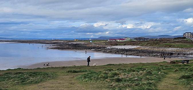
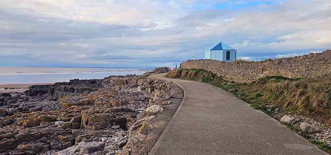
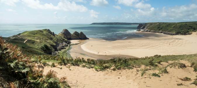
The first section of this walk is about 2.5 miles and will circle around the edge of the Golf course. We’ll follow sandy paths past the landmark water tower to see views of Three Cliffs Bay and the Castle.
We’ll continue to follow the edge of the golf course which will return us to the start point. Given the ongoing forecast of showers, we can have lunch in our cars before setting off on the second part of the walk. If dry, we can sit in the community garden.
The afternoon walk which is about 3.5 miles will pass through fields behind the school where many of the stiles have been replaced by gates. Walking through woodland, we emerge into fields and a farm track. We’ll then make our way to the coast path and enjoy views over the Bristol Channel.
We’ll walk west along the coast before turning inland to once more come close to the golf course. We’ll then pop into the Southgate Club for refreshments before making our way back to the cars (but if you prefer, you can go the short distance straight back along the pavement to the cars).
Stiles: None. Toilets: Pennard Cliff-Top Car Park. Terrain: Sandy, muddy, gentle ascents. Walking poles recommended.
Social after walk Just before reaching the cars, we will go for refreshments to The Southgate club. |
|||||||||||
|
|
Dogs remain on short leads |
||||||||||
|
Start: |
Starting Place: |
|
|||||||||
|
11:00 a.m. |
Pennard: School Car Park (Free) |
||||||||||
|
Directions: · From Swansea, head south on A4067, Oystermouth Road · Turn right to ascend B4436, Mayals Road (after The Woodman Inn). · Follow B4436 through Kittle. · Continue straight on at junction where B4436 turns right. · Follow road to 20MPH School sign. · Turn left into school car park before the pedestrian crossing.
|
|||||||||||
|
(Members can use the FREE Ramblers App as a Sat Nav to all our walks) |
|||||||||||
|
What3Words: prompts.grid.innovate |
Post Code: SA3 2DR |
||||||||||
|
Lat/Long: 51.5758, -4.0872 |
|
GR: |
SS |
554 883 |
|||||||
|
|
|||||||||||
|
|
|||||||||||
|
The Cliffs at Pennard |
|||||||||||
|
|
|||||||||||
|
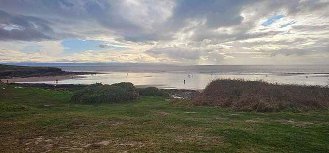
Three Cliffs Bay |
|||||||||||
|
|
|||||||||||
|
Saturday 21st February |
Briton Ferry Neath Canal and Woodland |
|
|
Leader: Clive Rees |
|
|
|
|
|
|
|
|
|
|
|
Walk cancelled – leader indisposed |
||
|
Sunday 22nd February |
Penclawdd |
||||||||||
|
Leader: Mike Clinch |
10.5 miles |
||||||||||
|
Tel: 07970-878393 |
Moderate |
||||||||||
|
|
|
||||||||||
|
|
|
||||||||||
|
Description:
A varied circular walk taking in the coastal path around Crofty, the ridge, a section of the Gower Way and the returning via the cycle path.
Hopefully the weather will allow fabulous views across the estuary.
Stiles: Three Stiles. Toilets: Near the start. Terrain: Varied but expect mud. There are a couple of short, steady climbs.
Social after walk: Afterwards, we will go for refreshments to Nomad Bar & Kitchen (Gowerton). |
|||||||||||
|
|
|||||||||||
|
|
Dogs remain on short leads |
||||||||||
|
Start: |
Starting Place: |
|
|||||||||
|
10:00 a.m. |
|||||||||||
|
Directions: · From Gowerton, follow B4295 westward to Penclawdd · Negotiate the double bend in the village · Pass over the pedestrian crossing · Turn immediately right into the car park (The Chip shop is to the left and GGs is to the right)
|
|||||||||||
|
(Members can use the FREE Ramblers App as a Sat Nav to all our walks) |
|||||||||||
|
What3Words: pining.skillet.area |
Post Code: SA4 3YF |
||||||||||
|
Lat/Long: 51.6429, -4.1038 |
|
GR: |
SS |
545 958 |
|||||||

|
Wednesday 25th February |
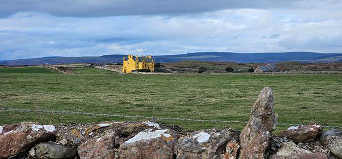
Cefn Bryn (the easy way!) |
||||||||||
|
Leader: Clive Scott |
5 miles |
||||||||||
|
Tel: 07369-299198 |
Leisurely |
||||||||||
|
|
|
||||||||||
|
|
|
||||||||||
|
Description:
A simple but stunning walk full of incredible 360-degree views.
A perfect walk for just strolling along and enjoying amazing views.
We shall walk the length of the spine of Gower, enjoying spectacular views for the entire walk (fingers crossed for no mist!).
We shall walk to Arthur’s Stone towards the end of the walk.
A great walk for birding, photography, creative inspiration or sharing some of the many folk tales, stories, and tales of Gower.
Stiles: No Stiles Toilets: King Arthur – (before or after the walk) Terrain:
Social after walk: Afterwards, we will go for refreshments to The King Arthur. |
|||||||||||
|
|
|||||||||||
|
|
Dogs remain on short leads |
||||||||||
|
Start: |
Starting Place: |
|
|||||||||
|
10:00 a.m. |
Cefn Bryn: Arthur’s Stone Car Park |
||||||||||
|
Directions: · Follow A4118 from Swansea to Gower through Killay. · Turn right onto B4271 for 4.6 miles. · Turn left just after fuel station in Cilibion. · After 1.7 miles along the road, the car park is on the right (rough stoney surface).
|
|||||||||||
|
(Members can use the FREE Ramblers App as a Sat Nav to all our walks) |
|||||||||||
|
What3Words: shippers.euphoric.planting |
Post Code: Unreliable |
||||||||||
|
Lat/Long: 51.5889, -4.1801 |
|
GR: |
SS |
490 900 |
|||||||

|
Thursday 26th February |
Three Cliffs A Taste of Gower Walk |
|||||||||
|
Leader: Lynne Esson |
3-4 miles |
|||||||||
|
Tel: 07754-435221 or 01792-845845 |
Leisurely |
|||||||||
|
|
|
|||||||||
|
|
|
|||||||||
|
Description:
This walk will take between 2 and 3 hours. Please note the start time to allow for public transport.
From the car park, we will walk down to Three Cliffs Bay.
Depending on whether the tide is in or out will decide which side of Pennard Pill we walk to the Gower Heritage Centre.
We will return via the drovers’ road to the cars.
Stiles: None Toilets: Gower Heritage Centre Terrain: Sandy / mud / stony
Public Transport: Bus No 118 from the Quadrant. (Please check the arrival time nearer the day)
Social after walk: Afterwards, we will go for refreshments to the Gower Inn.
|
||||||||||
|
|
Dogs remain on short leads |
|||||||||
|
Start: |
Starting Place: |
|
||||||||
|
10:00 a.m. |
Penmaen: N.T. car park behind St. John’s Baptist Church. |
|||||||||
|
Directions: · Take the A4118 heading to Oxwich. · Go through Parkmill. · Take 1st right at top of hill. · Once past St Johns Baptist Church, road will split into two. · Take right hand road over cattle grid and park on right.
|
||||||||||
|
(Members can use the FREE Ramblers App as a Sat Nav to all our walks) |
||||||||||
|
What3Words: booklets.gourmet.climbing |
Post Code: SA3 2HQ |
|||||||||
|
Lat/Long: 51.5788, -4.1210 |
|
GR: |
SS |
531 887 |
||||||

|
Saturday 28th February |
Porthcawl Coastal Walk
|
||||||||||
|
Leader: Alison Broady |
6 miles |
||||||||||
|
Tel: 07926-285806 |
Leisurely |
||||||||||
|
|
|
||||||||||
|
|
|
||||||||||
|
|
|||||||||||
|
The Coast path at Porthcawl |
|||||||||||
|
Description:
A fairly easy, mostly flat walk on firm surfaces with great views.
The walk begins by heading west along the seafront at Porthcawl.
We continue to Rest Bay and Sker Point along what is quite a surprisingly wild and rocky stretch of coast then head inland along quiet tracks and lanes into the historic village of Nottage.
From the village, we’ll make our way back to the seafront at Porthcawl.
Stiles: None Toilets: In Porthcawl, (near the promenade) | Rest Bay Terrain: Mostly flat and with firm surfaces.
Social after walk: Afterwards, we will go for refreshments to a local venue. |
|||||||||||
|
|
|||||||||||
|
|
Dogs remain on short leads |
||||||||||
|
Start: |
Starting Place: |
|
|||||||||
|
11:00 a.m. |
Porthcawl: Junction of Eastern Promenade & The Portway |
||||||||||
|
Directions: · M4 eastbound to Jct 37. · Take 3rd exit to follow A4229 southbound. · At 2nd roundabout go straight across onto A4106 (The Portway). · At Roundabout, take 1st exit, signposted Sandy Bay. · Turn right onto Eastern Promenade. · Park where convenient and walk south to the Marina. · N.B. Allow sufficient time to park in case parking spaces are taken.
|
|||||||||||
|
(Members can use the FREE Ramblers App as a Sat Nav to all our walks) |
|||||||||||
|
What3Words: skunks.thus.meatball |
Post Code: CF36 3TS |
||||||||||
|
Lat/Long: 51.4756, -3.7019 |
|
GR: |
SS |
819 765 |
|||||||
|
|
|||||||||||
|
|
|||||||||||
|
Sker House |
|||||||||||
|
|
|||||||||||
|
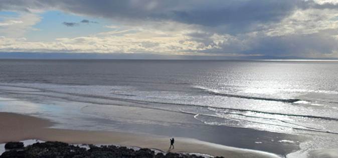
Looking across the Bristol Channel |
|||||||||||
|
|
|||||||||||
|
Lovely Sea views on this walk |
|||||||||||
|
|
|||||||||||
|
Walking west along the Wales Coast Path |
|||||||||||
|
|
|||||||||||