January
|
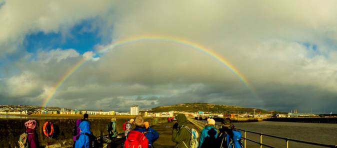
Saturday 10th January |
Summer House Hill and Swansea Vale
|
|||||||||
|
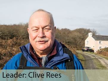
Leader: Clive Rees |
6.5 miles |
|||||||||
|
Tel: 07969-378750 |
Leisurely |
|||||||||
|
|
|
|||||||||
|
|
|
|||||||||
|
Description:
A walk through the Lower Swansea Valley.
We’ll walk from Llansamlet to the River Tawe where we will have our first coffee stop. We then follow the riverside path of the Tawe southward and stop at Fendrod Lake for our lunch. There is a café with toilets opposite.
After that, there will be a gentle ascent eastward towards Pentredwr on well-surfaced paths that pass by Winch-wen and Trallwn.
Crossing a busy road, we’ll follow paths and quiet streets onto Summer House Hill. Here we will have a second coffee stop to give us time to admire the extensive 360-degree view over Crymlyn Fen together with the valleys of Swansea and Neath.
From Summer House Hill, you have the option to continue on the walk for just over a mile OR to leave the walk to return to the start (a half-mile away) via Heol Hafty then turn left onto Frederick Place and right onto Bethel Road.
The rest of us will continue by descending into Cwm Crymlyn on the border with Neath Port Talbot. Here the path is rough so you’ll appreciate bringing your poles.
Joining another Active Travel Path, we pass through the now abandoned village of ‘The Grove of Battles’, or ‘Llwynbrwydrau’ although you’ll be hard-pushed to see it! This is on the old border of two Marcher Lordships, Gower and Glamorgan.
Following this path, we suddenly arrive back at our start point and consider it time to drive over to the Bowen’s Arms!
Stiles: No Stiles Toilets: In pub at end of walk | Northey Lights Café at Fendrod for customers. Terrain: Mixture of Active Travel Paths, pavements and muddy paths. Walking Poles recommended.
Social after walk: Afterwards, we will go for refreshments to Bowen’s Public House. (A short drive from where we are parked). |
||||||||||
|
|
Dogs remain on short leads |
|||||||||
|
Start: |
Starting Place: |
|
||||||||
|
11:00 a.m. |
Llansamlet: Frederick Place: Railway Station Car Park |
|||||||||
|
Directions: · Head east on A48 towards M4 J44 · Before reaching M4, (at traffic lights on cross roads), turn right onto Frederick Place. · Turn left at Station sign. · Drive into the car park behind the surgery.
|
||||||||||
|
(Members can use the FREE Ramblers App as a Sat Nav to all our walks) |
||||||||||
|
What3Words: lined.having.spell |
Post Code: SA7 9BL |
|||||||||
|
Lat/Long: 51.6611, -3.8842 |
|
GR: |
SS |
697 974 |
||||||

|
Sunday 11th January |
Horton and Port Eynon |
||||||||||
|
Leader: Mike Clinch |
8 miles |
||||||||||
|
Tel: 07970-878393 |
Ascent: 700ft (213m) |
||||||||||
|
|
Moderate |
||||||||||
|
|
|
||||||||||
|
Description:
A circular walk from Horton past Overton Cliff and around the coast to Port Eynon.
As well as fabulous
views, points of interest include:
Stiles: Several Stiles (both of wooden and stone construction). Toilets: At Horton Car Park. Terrain: Varied and includes road, fields and woodland with some paths being rocky and narrow. There are also a couple of short but challenging climbs. I’m anticipating mud in places.
Social after walk: Afterwards, we will go for refreshments to The King Arthur in Reynoldston. |
|||||||||||
|
|
|||||||||||
|
|
Dogs remain on short leads |
||||||||||
|
Start: |
Starting Place: |
|
|||||||||
|
10:00 a.m. |
Horton: Car Park at Horton Bay (charge) |
||||||||||
|
Directions: · Follow A4118 west to Scurlage. · Continue on the same road towards Port Eynon. · Take first left then the next right, signposted for Horton.
|
|||||||||||
|
(Members can use the FREE Ramblers App as a Sat Nav to all our walks) |
|||||||||||
|
What3Words: mixer.intention.snows |
Post Code: SA3 1LQ |
||||||||||
|
Lat/Long: 51.5484, -4.2029 |
|
GR: |
SS |
473 855 |
|||||||
|
Wednesday 14th January |
Path Maintenance Team Come and help us keep the paths open to walk |
|
|
Coordinator: Clive Scott |
|
|
|
Tel: 07369-299198 |
|
|
|
Email: path.maintenanceATswansearamblers.org.uk (N.B. Replace ‘AT’ with @) |
||
|
|
|
|
|
|
|
|
|
|
||
|
Description: On or around the 2nd Wednesday of each month, we assist the City & County of Swansea to maintain the network of footpaths.
The actual day we go out will depend on the work schedule of the council’s Countryside Access Team.
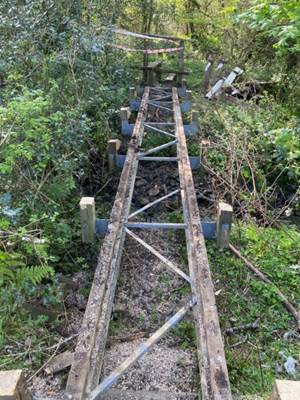
Our volunteer work may include everything from pruning and strimming to stile repairs and bridge building.
All are welcome to take part, so if you are interested in becoming a volunteer with our team, please contact the coordinator to find out more information. |
||

|
15th January |
Social Evening: Evening Meal at The Bay View (Plus, Leaders’ meeting to plan the next programme) |
||||||
|
|
|||||||
|
|
|||||||
|
The Bay View Hotel |
|||||||
|
We will be visiting the Bay View Hotel where we can enjoy a Thai meal.
Please note this will be on a Thursday evening.
Our previous social events with a Thai meal at the Bay View have always been enjoyed by us.
While the social is taking place, we will also be putting together the next programme, so if you are able to lead a walk, please think about a one (or more) that you could do for the group.
New Leaders: If you have never led before then have a chat with us; we will help you get started.
Maybe you could begin with an easy walk such as an evening stroll or a short walk on a Sunday or weekday. It’s not as hard as you think!
|
|||||||
|
|
|||||||
|
|
|||||||
|
Enjoying a previous social at the Bay View Hotel |
|||||||
|
|
|||||||
|
Parking: On-street parking is available in Francis Street and around the Guildhall. |
|||||||
|
|
|||||||
|
Meet: |
Meeting Place: |
|
|||||
|
7:00 p.m. |
The Bay View Hotel: (Near Guildhall)
|
||||||
|
Directions: The Bay View Hotel is on junction of Oystermouth Road (A4067) and St. Helen’s Road, near the Guildhall.
|
|||||||
|
What3Words: covers.games.supper |
Post Code: SA1 3UL |
||||||
|
Lat/Long: 51.6127, -3.9591 |
GR: |
SS |
644 922 |
||||
|
Saturday 17th January |
Murton and Bishop’s Wood |
|||||||||
|
Leader: Morag Eddyshaw |
5 miles |
|||||||||
|
Tel: 07751-444535 |
Moderate |
|||||||||
|
|
|
|||||||||
|
|
||||||||||
|
Description:
This is a varied walk with some lovely views if the weather is favourable.
From Murton, we will head towards Bishopston Valley. We then skirt round the edge of the valley before picking up the route down to the coast path. From there we go to Caswell via Brandy Cove. Our return to Murton will be via Bishop’s Wood.
Stiles: No stiles. Terrain:
Toilets: At Caswell Bay.
Social after walk: After the walk we will go to the Beaufort Arms in Kittle, (about 5 minutes’ drive from the meeting place).
|
||||||||||
|
|
Dogs remain on short leads |
|||||||||
|
Start: |
Starting Place: |
|
||||||||
|
11:00 a.m. |
Murton: Junction of Tudor Way and Manselfield Road
|
|||||||||
|
Directions: · From Swansea, follow A4067, Mumbles Road. · At Blackpill, turn right at lights onto Mayals Road, B4436. · Follow B4436 for approx. 2 miles and then take left turn into Murton. · Continue straight for 250m to T-junction with Manselfield Road. · Turn right and Tudor Way is next turn to the left. · Use on-road parking either in Tudor Way or Long Acre. · (please park considerately).
|
||||||||||
|
(Members can use the FREE Ramblers App as a Sat Nav to all our walks) |
||||||||||
|
What3Words: circular.attention.preparing |
Post Code: SA3 3AT |
|||||||||
|
Lat/Long: 51.5829, -4.0426 |
|
GR: |
SS |
586 891 |
||||||

|
Sunday 18th January |
Hendy & Troserch Wood
|
|||||||||
|
Leader: Karen Gibbs |
9 miles |
|||||||||
|
Tel: 07748-349264 |
Moderate |
|||||||||
|
|
|
|||||||||
|
Description: A farmland walk using parts of the Heart of Wales Line Trail and St. Illtud’s Walk
Social after walk: Afterwards, we will go for refreshments to a suitable venue. |
||||||||||
|
|
||||||||||
|
|
Assistance Dogs Only |
|||||||||
|
Start: |
Starting Place: |
|
||||||||
|
10:00 a.m. |
Hendy: Clos Ty-Gwyn (Roadside Parking) |
|||||||||
|
Directions: · M4 Junction 48 (Pontarddulais/Hendy): take slip road to traffic lights. · Turn right onto A4138 (Pontarddulais Road) into Hendy. · On entering village, turn left onto Heol y Parc (B4306). · Turn first left again into Maesderi housing estate · Follow this road to crossroads with Heol Morlais · Go straight across onto Clos Ty-Gwyn. · Roadside parking but please be considerate to residents. · Meet point is at the top of the close near the garages.
|
||||||||||
|
(You can use the Ramblers App as a Sat Nav to all our walks) |
||||||||||
|
What3Words: rising.dissolves.magpie |
Post Code: SA4 0FG |
|||||||||
|
Lat/Long: 51.7133, -4.0630 |
|
GR: |
SN |
575 036 |
||||||
|
Wednesday 21st January |
Southgate to Caswell circular |
||||||||||
|
Leader: Clive Scott |
7 miles |
||||||||||
|
Tel: 07369-299198 |
Moderate |
||||||||||
|
|
|
||||||||||
|
|
|
||||||||||
|
Description: We will follow the coast path along East Cliff, passing Vernon Watkins memorial stone and High Pennard hill fort.
We then walk down from Pwlldu Head to Gravesend and hear of the tragic story of the wreck of The Caesar.
We shall carry on to Pwlldu Bay with its history of quarrying and smuggling. We’ll follow the coast path to Brandy Cove, (another bay associated with smuggling) and where the murdered body of Maimie Stewart was found.
Continuing to Caswell, we’ll walk up Caswell Valley into Bishopswood where we will see the ruins of St. Peter’s medieval chapel and Well.
Returning past the recently revealed Backingstone medieval chapel, we shall walk across the valley and back to Southgate.
Stiles: No Stiles Toilets: 1. NT Car Park | 2. In Caswell Terrain: Uneven, possibly muddy and rocky. One short, steep descent and ascent at Gravesend
Social after walk: Afterwards, we will go for refreshments to Three Cliffs Coffee Shop. |
|||||||||||
|
|
|||||||||||
|
|
Dogs remain on short leads |
||||||||||
|
Start: |
Starting Place: |
|
|||||||||
|
10:00 a.m. |
Southgate: Pennard Cliffs: National Trust Car Park (Charge) |
||||||||||
|
Directions: · From Swansea, head south on A4067, Oystermouth Road · Turn right to ascend B4436, Mayals Road (after The Woodman Inn) · Follow B4436 through Kittle · Continue straight on at junction where B4436 turns right · Follow road through Southgate Village to roundabout · Park in the cliff-top car park
|
|||||||||||
|
(You can use the Ramblers App as a Sat Nav to all our walks) |
|||||||||||
|
What3Words: surprises.segmented.bedrock |
Post Code: SA3 2DJ |
||||||||||
|
Lat/Long: 51.5671, -4.0878 |
|
GR: |
SS |
554 874 |
|||||||
|
Saturday 24th January |
Neath Abbey |
|||||||||
|
Leader: Clive Rees |
6 miles |
|||||||||
|
Tel: 07969-378750 |
Leisurely |
|||||||||
|
|
|
|||||||||
|
|
||||||||||
|
Description: We will be walking along the Tennant Canal to Aberdulais where there is that fabulous old aqueduct.
Then back along the Neath Canal into Neath itself where we can see the castle.
Stiles: There are no stiles on this walk Toilets: In Neath Town Centre Terrain: There are no hills at all so it’s a good walk if one is a bit unsteady.
Social after walk Afterwards, we will go for refreshments to The Bowens Arms (Skewen).
|
||||||||||
|
|
Dogs remain on short leads |
|||||||||
|
Start: |
Starting Place: |
|
||||||||
|
11:00 a.m. |
Neath Abbey |
|||||||||
|
Directions: · Head east on Fabian Way (A483) · Join M4 towards Carmarthen in the A465 (Neath) lane, to leave at the next junction. · At the M4 roundabout, take the 3rd exit to join the A465. · Exit left at sign for Neath Abbey Industrial Estate. · At T-Junction, turn right. · You can park at the end of this road OR · Turn right to park nearer the Abbey (if there is space). |
||||||||||
|
|
||||||||||
|
(Members can use the FREE Ramblers App as a Sat Nav to all our walks) |
||||||||||
|
What3Words: gloves.grabs.inform |
Post Code: SA10 7DW |
|||||||||
|
Lat/long: 51.6609, -3.8274 |
|
GR: |
SS |
737 973 |
||||||

|
Thursday 29th January |
Langland/Rotherslade/Mumbles Hill A Taste of Gower Walk |
|||||||||
|
Leader: Al Evans |
4 miles |
|||||||||
|
Tel: 07791-408184 |
Leisurely |
|||||||||
|
|
|
|||||||||
|
|
|
|||||||||
|
Description:
An ideal winter walk on some hard surfaces but I’m sure I’ll find you some mud!!
From the seafront at Langland, we follow the Wales Coast Path to Fortes. Then onto Mumbles Hill, following the Mumbles Way back to Underhill Park.
Stiles: None Toilets: At café afterwards Terrain: N.B. The path is undulating in places on Mumbles Hill
Social after walk: Afterwards, we will go for refreshments either to the café in Underhill Park or in Mumbles. |
||||||||||
|
|
Dogs remain on short leads |
|||||||||
|
Start: |
Starting Place: |
|
||||||||
|
11:00 a.m. |
Mumbles: Underhill Car Park – (northern edge)
|
|||||||||
|
Directions: · Drive up Newton Road, Oystermouth. · After the shops, go straight through traffic lights (Underhill Park on left). · Just as playing fields end (and immediately before first houses on left hand side), turn left into free car park.
|
||||||||||
|
(Members can use the FREE Ramblers App as a Sat Nav to all our walks) |
||||||||||
|
What3Words: calms.unfair.dwarf |
Post Code: SA3 4SW |
|||||||||
|
Lat/Long: 51.5730, -4.0110 |
|
GR: |
SS |
607 879 |
||||||